Tornado Warnings in Southeast Louisiana
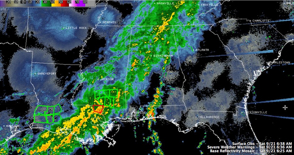
There have been a few tornado warnings in southeastern Louisiana this morning.
There currently is one in effect for Washington Parish in eastern Louisiana along the Mississippi border.
Instabilities in that area are in the 1,000 j/kg range, with higher instability air feeding into there from the south off the Gulf.
Some of this stronger instability will work into southwestern and West Central Alabama late this morning, with a small threat for some strong storms south of a line from Demopolis to Clanton to Alexander City into the afternoon.
We can’t rule out a storm or two becoming severe, and there is a very small threat of a brief spin up tornado with any stronger cells.
Right now in West Central Alabama, a developing thunderstorm was near Union over Greene County. This will pass near and south of Tuscaloosa over the next hour with heavy rain and a few lightning strokes possible. This activity is associated with a the best pocket of instability (around 500-1000 /kg) Central Alabama. There is a decent amount of wind shear right now over Central Alabama as well, so we will be monitoring any developing storms for the chance they could rotate and produce a brief, weak tornado as well.
We don’t expect a tornado watch in Central Alabama.
Category: Alabama's Weather
About the Author (Author Profile)
Bill Murray is the President of The Weather Factory. He is the site's official weather historian and a weekend forecaster. He also anchors the site's severe weather coverage. Bill Murray is the proud holder of National Weather Association Digital Seal #0001 @wxhistorianSubscribe
If you enjoyed this article, subscribe to receive more just like it.


