Evening Notes on Karen
QUICK FACTS AT 7 PM…
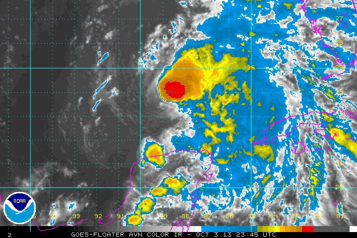
LOCATION…23.8N 88.9W
ABOUT 480 MILES SOUTH SOUTHWEST OF MOBILE
MAXIMUM SUSTAINED WINDS…65 MPH…100 KM/H
PRESENT MOVEMENT…NNW OR 330 DEGREES AT 12 MPH…19 KM/H
MINIMUM CENTRAL PRESSURE…999 MB…29.50 INCHES
After an impressive period of increasing convection early today, Karen has certainly become less organized this afternoon. AF Mission 03 in to the storm made its fourth fix of the center at 6:20 p.m. The pressure was up a little to 999 mb. The maximum flight levels winds the crew found on the last inbound pass from the west was 31 mph, which translates to just under 30 mph at the surface. But stronger flight level winds 65 knots or 75 mph) were measured as the plane flew a northbound leg out of the center. So there are definitely tropical storm force winds in the northeast quadrant.
The system is undergoing moderate shear (about 20 knots of it). The shear should remain at this level until Saturday, when it will increase ahead of the approaching cold front. There is also a lot of dry air to the west of the storm as well. These factors are against intensification. but it is over water that is marginally warm enough for strengthening. Most of the intensity guidance indicates that Karen will become a hurricane for a period of time Friday into early Saturday. It does appear that convection is trying to reform near the center, so this may be the beginning of an overnight strengthening trend.
We remember what happened during Hurricane Opal on this exact night in 1995. The storm increased dramatically to nearly category five intensity, but fortunately it weakened before landfall the following afternoon. We don’t expect anything like that since the water Karen will be passing over is much cooler and atmospheric conditions are not as conducive this time.
Category: Tropical
About the Author (Author Profile)
Bill Murray is the President of The Weather Factory. He is the site's official weather historian and a weekend forecaster. He also anchors the site's severe weather coverage. Bill Murray is the proud holder of National Weather Association Digital Seal #0001 @wxhistorianSubscribe
If you enjoyed this article, subscribe to receive more just like it.


