An Unorganized Karen
Karen continues to struggle against wind shear and dry air. This is a very unorganized and lopsided storm for these reasons. The center of circulation continues to be well displaced from the convection on the eastern side of the storm. Intensification of the system does not look likely unless some convection begins to develop around the center of circulation.
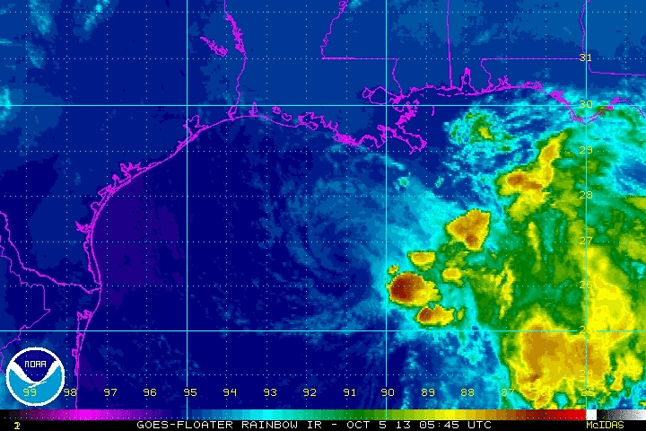
LOCATION…27.5N 91.5W
ABOUT 155 MI…245 KM S OF MORGAN CITY LOUISIANA
ABOUT 185 MI…295 KM SW OF THE MOUTH OF THE MISSISSIPPI RIVER
MAXIMUM SUSTAINED WINDS…40 MPH…65 KM/H
PRESENT MOVEMENT…N OR 350 DEGREES AT 10 MPH…16 KM/H
MINIMUM CENTRAL PRESSURE…1008 MB…29.77 INCHES
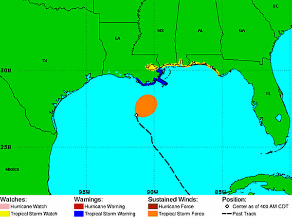
Tropical storm winds are confined to the eastern and northeastern side of the system. This is expected to continue until the system makes landfall. Karen is moving north now, and is still expected to make a sharp northeast turn as a cold front and trough move into the Southeast and will draw her up. Tropical Storm watches and warnings remain in along the Gulf Coast today, and we expect to see changes in these advisories as we head throughout the day as Karen nears the coast.
Category: Alabama's Weather, Tropical
About the Author (Author Profile)
Macon, Georgia Television Chief Meteorologist, Birmingham native, and long time Contributor on AlabamaWX. Stormchaser. I did not choose Weather, it chose Me. College Football Fanatic. @Ryan_StinnetSubscribe
If you enjoyed this article, subscribe to receive more just like it.


