A Mostly Sunny and Very Warm Day, but Change is Coming
An unseasonably warm day across much of the Southeast as an area of high pressure off to our east remains the dominant feature controlling our weather. Skies across Alabama are mostly sunny with just a few cumulus clouds. Today, that area of high pressure is beginning to move off to the east as a long wave trough is digging in across the eastern U.S. That trough is forcing the area of high pressure out and will allow a mid-latitude cyclone and cold front to push across the eastern half of the country.
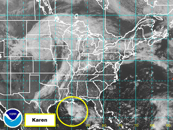
This trough will also begin to draw Tropical Storm Karen northeastward. Karen is spinning in the central Gulf of Mexico, and the area of low pressure with our next storm system is over South Dakota. This is classic looking system, with a warm front out ahead of the system and a cold front pushing through the Mississippi River Valley. The cold front shows up very well on the visible satellite image as a clearing is ongoing behind it. That front is bringing with it much cooler air into the U.S. Once the front passes, many areas will have a true feel of fall. This front, and the showers and thunderstorms associated with it are expected to move into Alabama tomorrow and should clear the state by Monday morning.
Category: Alabama's Weather
About the Author (Author Profile)
Macon, Georgia Television Chief Meteorologist, Birmingham native, and long time Contributor on AlabamaWX. Stormchaser. I did not choose Weather, it chose Me. College Football Fanatic. @Ryan_StinnetSubscribe
If you enjoyed this article, subscribe to receive more just like it.


