Front Crossing the State Overnight
As expected, showers and few thunderstorms have developed along the front moving across northern Mississippi and central Tennessee. This activity will persist along the frontal boundary as it heads into north-central Alabama. This line of activity has made it into northwestern Alabama and will continue to move southeast during the overnight hours. Over the next few hours, these storms are expected to slowly weaken. Though some storms could hold together, most areas will just see a quick burst of rain. There may be some gusty winds with this boundary, but no severe storms are expected in Alabama during the overnight hours.
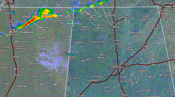
Heading through the overnight hours the cold front will continue to cross the state from northwest to southeast. Locations will remain very mild for tonight, but once the front passes, the winds will shift out of the northwest and some cooler temperatures will begin to flow into Alabama. As the front passes, showers will taper off and conditions will begin to improve. Below is a great graphic by the NWS Birmingham on the timing of the front moving through the state.

Category: Alabama's Weather
About the Author (Author Profile)
Macon, Georgia Television Chief Meteorologist, Birmingham native, and long time Contributor on AlabamaWX. Stormchaser. I did not choose Weather, it chose Me. College Football Fanatic. @Ryan_StinnetSubscribe
If you enjoyed this article, subscribe to receive more just like it.


