

Messy Storm System Ahead
Brian Peters will be along with a full discussion and Weather Xtreme video shortly… this is just a look at the pre-Thanksgiving storm that will impact Alabama.
TO THE WEST: A winter storm warning is up for much of Texas this morning due to potential ice accumulation…
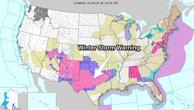
I should note that there is a “red flag warning” up for much of Alabama due to the danger of wildfires; that is not a winter weather advisory of any kind.
TOMORROW: After another cold morning, clouds will increase during the day, and due to the dry air in place initially, sleet will likely fall across North Alabama late tomorrow afternoon. Temperatures will be in the 40s and this won’t create any problems. Rain becomes widespread late tomorrow night.
SOAKING RAIN TUESDAY: A cold, soaking rain will fall Tuesday. With a surface low passing just to the south.
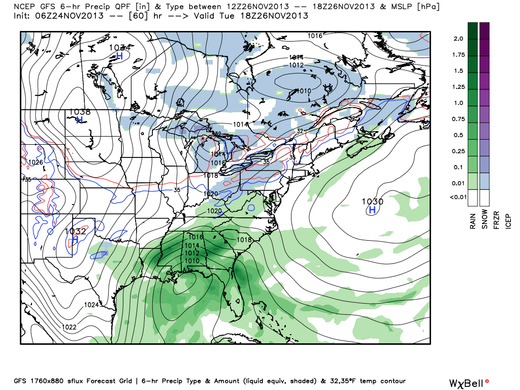
Rain amounts of 2 to 3 inches are likely before it all ends… below is the QPF guidance from WPC…
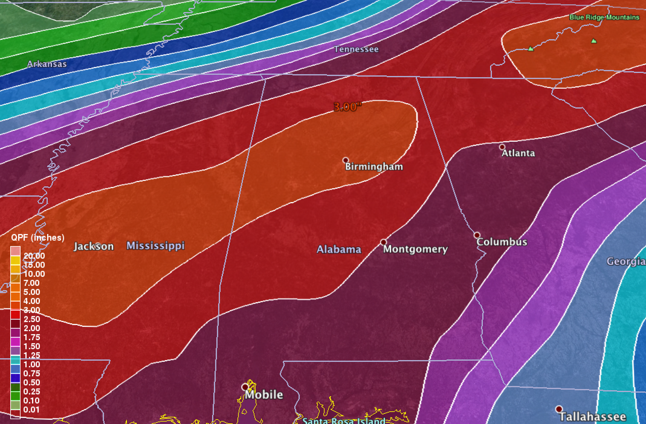
Don’t think it will be enough to cause any flash flooding, but it will be a huge wet-down.
SNOW FLAKES WEDNESDAY? Before the rain ends, there is still some risk of rain changing over to snow briefly somewhere over Alabama. Below is the GFS model output (surface) valid at noon Wednesday…
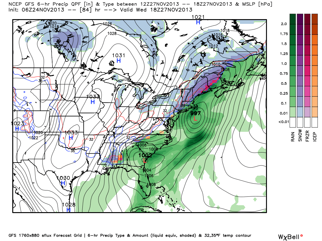
And, the upper air pattern (500 mb) at the same hour…
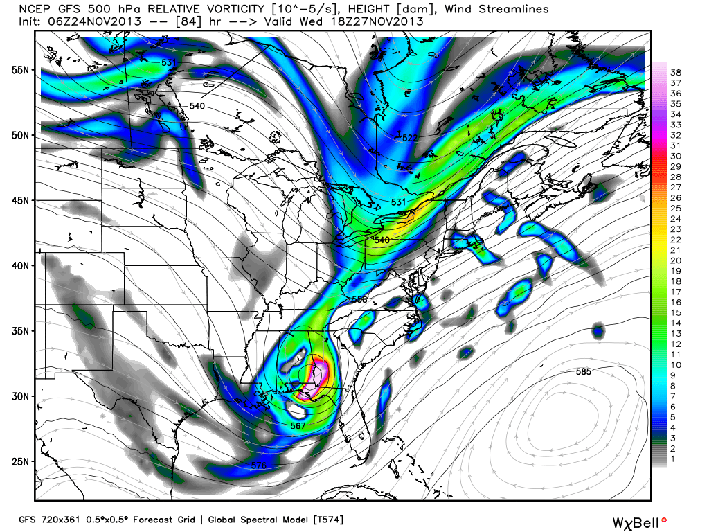
With cold air moving in on the back side of the departing surface low, and dynamic cooling from the upper low, that could certainly bring the possibility of a touch of snow into play. I think the key will be the position of the upper low, and the potential dynamic cooling from that feature. As you can see, the GFS has the upper low actually passing over South Alabama, meaning places like Selma, Montgomery, Auburn, Troy, and Greenville might have a better chance of a few snow flakes than the northern part of the state, but that is just speculation now.
We will have a much better idea of how this will work as it begins to move out of Texas tonight and tomorrow. For now, we will just mention a chance of light snow as the rain ends Wednesday with no accumulation. But, also remember skill in dealing with a winter weather situation like this three days in advance is low. Stay tuned…
Category: Alabama's Weather
About the Author (Author Profile)
James Spann is one of the most recognized and trusted television meteorologists in the industry. He holds the AMS CCM designation and television seals from the AMS and NWA. He is a past winner of the Broadcast Meteorologist of the Year from both professional organizations.Subscribe
If you enjoyed this article, subscribe to receive more just like it.


