A Few Storms, Cold Air Moving-In
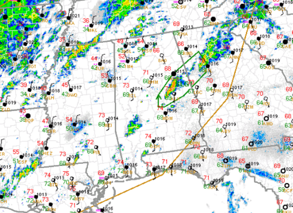
The SPC has trimmed back the severe weather threat for Alabama tonight. Only a small slither of East Alabama remains outlined in a slight risk for severe weather, and that is because there is a cluster of thunderstorms within the area. The risk area, outlined in green, includes potions of Chambers, Randolph, Tallapoosa, Talladega, Clay, Coosa, Cleburne, Elmore Counties, and stretches east into the Atlanta Metro.
Once this cluster of storms moves out of the state, it looks as though any threat of severe weather will be gone. Overnight, we are still expecting some showers and storms to develop across Central Alabama and these showers and storms could produce some gusty winds and heavy downpours, but severe weather is not expected.
Most of Alabama remains very balmy, but that is changing. The cold front has made it into Alabama and temperatures are falling through the 50s and into the 40s across our northwestern counties. That colder air is slowly seeping south into central Alabama, and you will definitely notice the change in air mass for your Friday.
Category: Alabama's Weather
About the Author (Author Profile)
Macon, Georgia Television Chief Meteorologist, Birmingham native, and long time Contributor on AlabamaWX. Stormchaser. I did not choose Weather, it chose Me. College Football Fanatic. @Ryan_StinnetSubscribe
If you enjoyed this article, subscribe to receive more just like it.


