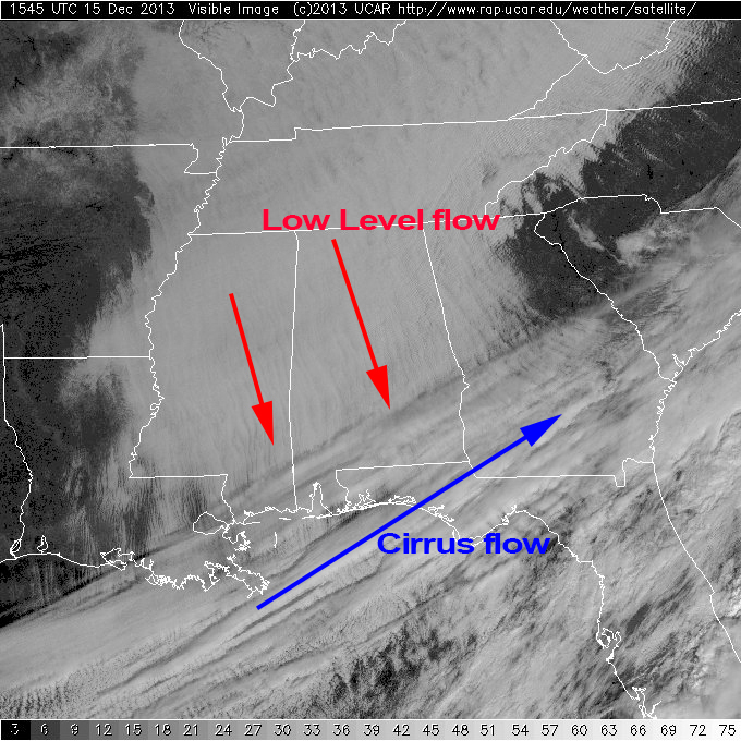
Flow Seen in Satellite View
The satellite view from the GOES satellites today in the visible imagery clearly shows the flow of air in the low levels and upper levels. In the low levels, you can see the clouds aligned along a northwest to southeast direction coincident with the flow of air at 20 to 25 knots. But over South Alabama, the flow is delineated by the higher cirrus clouds blowing at 50 to 70 knots from the southwest to northeast.
Temperatures at most observing sites across North and Central Alabama have not changed much so far today with readings still in the middle 30s across the Tennessee Valley counties to middle 40s in the Montgomery area. With a brisk north to northwest low level flow, the wind chill produces a feeling of readings in the upper 20s to lower 30s. So if you need to head outdoors today, be sure to bundle up against the cold.
-Brian-
Category: Alabama's Weather
About the Author (Author Profile)
Brian Peters is one of the television meteorologists at ABC3340 in Birmingham and a retired NWS Warning Coordination Meteorologist. He handles the weekend Weather Xtreme Videos and forecast discussion and is the Webmaster for the popular WeatherBrains podcast.Subscribe
If you enjoyed this article, subscribe to receive more just like it.


