More Rain Later This Week
An all new edition of the ABC 33/40 Weather Xtreme video is available in the player on the right sidebar of the blog. You can subscribe to the Weather Xtreme video on iTunes by clicking here.
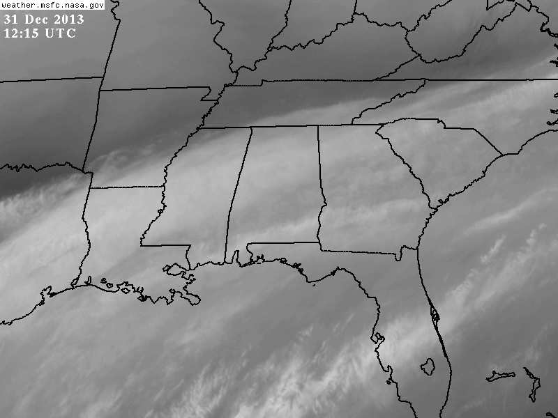
PESKY CLOUDS: We had hoped for a good supply of sunshine across Alabama today, but the sub-tropical jet stream hasn’t moved overnight, and it will make it tough to see much sun today. The low clouds should thin out late this morning, but a veil of high clouds will hang over the state through tomorrow. Today will remain colder than average for December 31 with a high only in the mid 40s.
Tomorrow will be warmer with a high in the 50s.
NEXT RAIN EVENT: More rain will move into Alabama late tomorrow night ahead of a cold front, and developing surface low in the northern Gulf of Mexico. Seems like the main window for rain will come from 2:00 a.m. until 2:00 p.m. Thursday. No severe weather, no thunder… rain amounts of around 1/2 inch are likely around here (Birmingham, Tuscaloosa, Anniston, Gadsden, etc), with totals closer to one inch near the Gulf Coast.
SNOW FLAKES? And, as the rain ends Thursday afternoon, much colder air spills into Alabama. I expect temperatures in the 40s Thursday morning as the rain falls, but readings should drop into the 30s Thursday afternoon, and there is some chance we might see a few snow flakes on the back side of the departing mass of precipitation over North Alabama. Any snow won’t do much other than generate some conversation here; if you want to see accumulating snow Thursday, best chance of that is along and north of I-40 up in North Tennessee and Kentucky.
VERY COLD DAY FRIDAY: The latest GFS is printing a low of 19 degrees for Birmingham at daybreak Friday… some of the colder spots could reach the mid teens across the northern half of the state with a clear sky. The day Friday will be cold despite the return of sunshine; a good chance we won’t get out of the 30s.
THE ALABAMA WEEKEND: Saturday morning will be very cold with a low between 18 and 23, but we warm into the mid to upper 40s by afternoon with a good supply of sunshine. The latest GFS brings in an impulse Sunday with clouds, and even some risk of a little light rain in spots. There won’t be much moisture to work with, but we will introduce that possibility into the forecast. Sunday’s high will be in the 48-52 degree range.
ARCTIC BLAST NEXT WEEK: I think there is a very good possibility we see the coldest air so far this season early next week, but just “how cold” remains to be seen. The latest run of the European model (ECMWF) still brings record breaking cold into the Deep South by Tuesday morning, with sub-zero values over the Tennessee Valley, and single digits down to I-20. This seems too aggressive; it is very hard to get that cold in Alabama with no snow on the ground.
The GFS is much warmer, and I think the truth is somewhere in between. Based on current observations up in the source airmass over Canada and the northern U.S. (Ely, MN is at -33 (F) as I write this), I do think we could see lows in the 10-15 degree range early Tuesday or Wednesday morning, with a high between 28 and 32 on Tuesday or Wednesday (depending on the timing of the cold air). We will just have to wait and see before we can get too specific.
See the Weather Xtreme video for the maps, graphics, and details.
SUGAR BOWL WEATHER: For Alabama fans headed to New Orleans for the Sugar Bowl (Thursday night; 7:30p CT kickoff), the weather will be generally cloudy in New Orleans through Thursday. Just a few widely scattered showers today, becoming more widespread tomorrow and tomorrow night. The rain should taper off and end by midday Thursday. Nothing too heavy, and no severe weather. Afternoon highs will be mostly in the 50s; colder and drier air arrives Friday with the sun finally breaking through. The high Friday will drop into the 40s.
BCS NATIONAL CHAMPIONSHIP WEATHER: For now it looks like routine southern California weather for Auburn fans making the trip out west. No rain for the next 7-10 days at Pasadena, CA; highs are in the 70s, with lows between 47 and 52. Lots of sun.
BBVA COMPASS BOWL: A perfect day for football in Birmingham Saturday, when Vanderbilt and Houston match up at 12:00 noon. Lots of sun; the kickoff temperature will be near 42 degrees, rising to near 47 by the final whistle. No risk of rain.
WEATHER BRAINS: Don’t forget you can listen to our weekly 90 minute netcast anytime on the web, or on iTunes. This is the show all about weather featuring many familiar voices, including our meteorologists here at ABC 33/40. Scroll down for the show notes on the new episode we recorded last night with Greg Carbin of the Storm Prediction Center.
CONNECT: You can find me on all of the major social networks…
Facebook
Twitter
Google Plus
Instagram
We are on a holiday schedule, so just one video per day through tomorrow. I will write a fresh discussion here on the blog by 4:00 this afternoon…
Category: Alabama's Weather
About the Author (Author Profile)
James Spann is one of the most recognized and trusted television meteorologists in the industry. He holds the AMS CCM designation and television seals from the AMS and NWA. He is a past winner of the Broadcast Meteorologist of the Year from both professional organizations.Subscribe
If you enjoyed this article, subscribe to receive more just like it.


