

Falling Temperatures; Harsh Winds
An all new edition of the ABC 33/40 Weather Xtreme video is available in the player on the right sidebar of the blog. You can subscribe to the Weather Xtreme video on iTunes by clicking here.
HERE COMES THE COLD AIR: This will be a day of falling temperatures as intense cold air advection kicks in across Alabama. At daybreak, temperatures are in the mid 40s in many locations across North/Central Alabama, but we should fall into the mid 30s by mid-morning, and then only climb to near 40 degrees this afternoon.
Strong north winds averaging 15-30 mph will make it feel colder, and a wind advisory is in effect for all 67 Alabama counties today.
You might hear of a few snow flurries over the northeast corner of the state, but the air is dry and most places won’t see a flake. In fact, it is a dry pattern for the rest of January.
By daybreak tomorrow most communities will drop into the 15-19 degree range. Tomorrow will be sunny with a high between 37 and 40, but the wind won’t be nearly as fierce as what we will experience today.
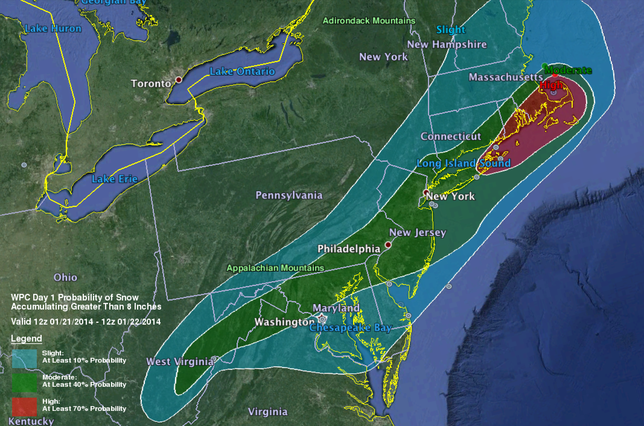
ATTENTION TRAVELERS: A winter storm warning is up from Virginia to the coast of New England, some places there could see over 8 inches of snow during the next 24 hours…
SECOND SHOT OF ARCTIC AIR: Phase two of the cold air arrives Thursday. The high will drop into the low to mid 30s, and winds will pick up again, keeping the wind chill index below freezing all day despite a sunny sky. The coldest morning should come early Friday, when we expect a low in the 10-15 degree range.
Friday will be another day with a struggle to get above freezing; the GFS is printing a high of 35 degrees for Birmingham Friday afternoon.
THE ALABAMA WEEKEND: Saturday morning will be cold again with a low between 16 and 22 degrees. But, we warm up nicely during the day with a high close to 50 degrees Saturday afternoon along with a good supply of sunshine. Sunday will also feature a sunny sky with a high near 50. No rain, no snow.
NEXT WEEK: Yet another shot of colder air arrives Monday night and Tuesday; the high Tuesday will drop back into the 40s. No sign of any significant precipitation through the end of January; the 06Z GFS hints our next big rain event could be in early February. See the Weather Xtreme video for the maps, graphics, and details.
WEATHER BRAINS: Don’t forget you can listen to our weekly 90 minute netcast anytime on the web, or on iTunes. This is the show all about weather featuring many familiar voices, including our meteorologists here at ABC 33/40. Scroll down for the show notes on the new episode we recorded last night.
CONNECT: You can find me on all of the major social networks…
Facebook
Twitter
Google Plus
Instagram
Busy day ahead… I have weather programs today at Weaver Elementary in Calhoun County, and Briarwood Christian School in Birmingham. Look for the next Weather Xtreme video here by 4:00 or so this afternoon. Enjoy the day!
Category: Alabama's Weather
About the Author (Author Profile)
James Spann is one of the most recognized and trusted television meteorologists in the industry. He holds the AMS CCM designation and television seals from the AMS and NWA. He is a past winner of the Broadcast Meteorologist of the Year from both professional organizations.Subscribe
If you enjoyed this article, subscribe to receive more just like it.


