

Big Time Cold Settles Into Alabama
An all new edition of the ABC 33/40 Weather Xtreme video is available in the player on the right sidebar of the blog. You can subscribe to the Weather Xtreme video on iTunes by clicking here.
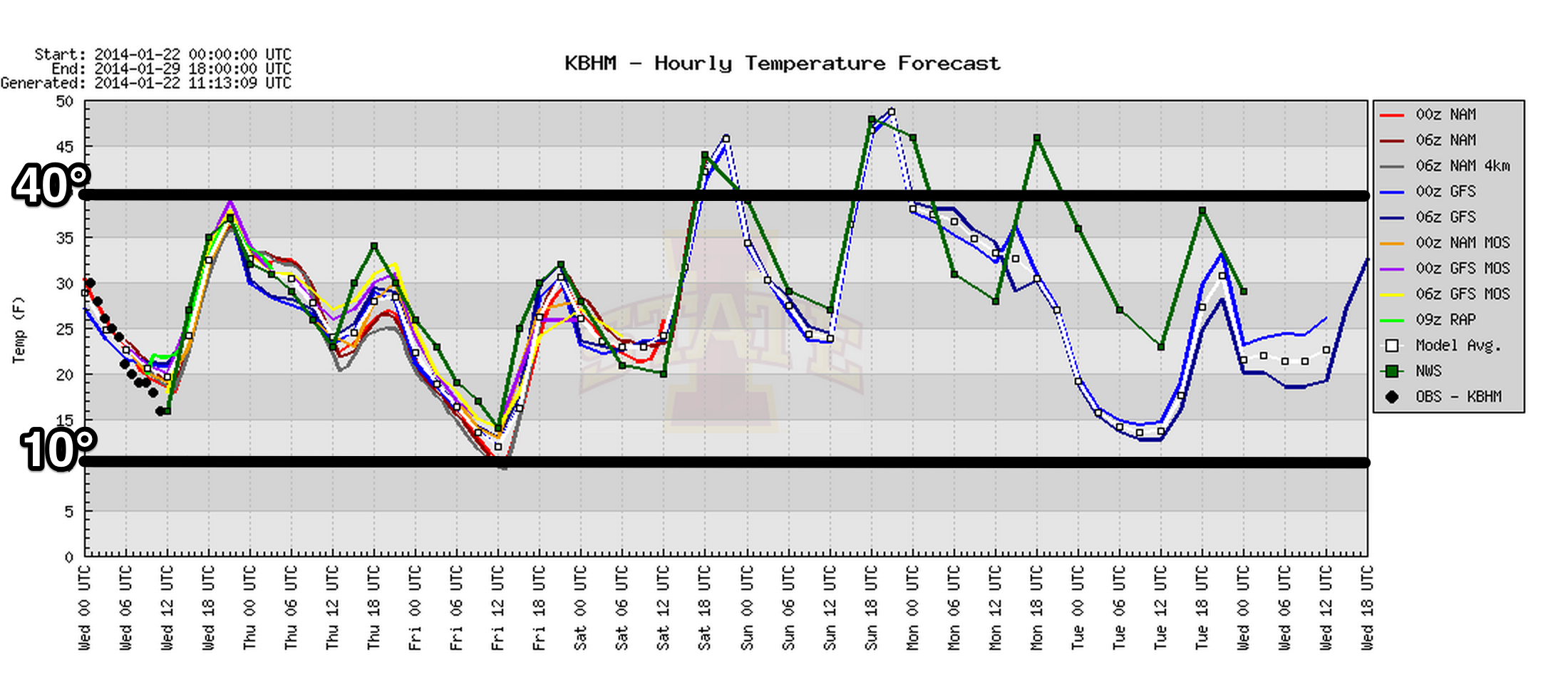
EXTENDED PERIOD OF ARCTIC AIR: Today will be our “warmest” day through Friday; we will enjoy a sunny sky with a high in the upper 30s. And, thankfully the wind will be much calmer.
Then, tomorrow, the second phase of the cold air arrives with a biting northwest wind of 12-25 mph. The high will be around 32 degrees, and the wind chill index will remain well below freezing all day.
FRIDAY MORNING: The latest GFS model is printing a low of 10 degrees for Birmingham; we will revise our forecast low for early Friday into the 8 to 13 degree range. Friday will be sunny but very cold; again the high will be only in the low 30s, but at least the wind won’t be as bad.
LONG DURATION PERIOD OF SUB-FREEZING WEATHER: For a number of North/Central Alabama communities (but not all), we expect now to be below freezing from around 6:00 pm today through 10:00 am Saturday… a total of 64 consecutive hours. The next time we see 40 degrees will be Saturday afternoon.
Be sure and check on elderly people that might not have an adequate source of heat… be VERY careful when using space heaters (we have had many house fires due to these in recent weeks)… bring in the pets and wrap the pipes. Keep that water dripping tomorrow night.
THE ALABAMA WEEKEND: We finally rise into the 40s Saturday afternoon, and we should hit the low to mid 50s Sunday. Dry air stays in place, and the weekend will feature a good supply of sunshine.
MORE COLD AIR NEXT WEEK: The GFS is getting more aggressive with the next shot of cold air early next week; Monday could very well be a day like yesterday with strong north winds and falling temperatures. Doubtful we get out of the 30s Tuesday after a low in the teens early Tuesday morning.
LONG RANGE/LAND OF VOODOO: The 06Z run of the GFS shows a good rain/storm event here around February 4, followed by yet another shot of Arctic air February 6. Take some time to watch the Weather Xtreme video for the maps, graphics, and details.
WEATHER BRAINS: Don’t forget you can listen to our weekly 90 minute netcast anytime on the web, or on iTunes. This is the show all about weather featuring many familiar voices, including our meteorologists here at ABC 33/40.
CONNECT: You can find me on all of the major social networks…
Facebook
Twitter
Google Plus
Instagram
I will be doing a weather program today at Bluff Park Elementary School in Hoover… look for the next Weather Xtreme video here by 4:00 this afternoon. Enjoy the day!
Category: Alabama's Weather
About the Author (Author Profile)
James Spann is one of the most recognized and trusted television meteorologists in the industry. He holds the AMS CCM designation and television seals from the AMS and NWA. He is a past winner of the Broadcast Meteorologist of the Year from both professional organizations.Subscribe
If you enjoyed this article, subscribe to receive more just like it.


