

South Alabama Snow Potential
Brian will be along in a bit with the regular morning forecast discussion and a new Weather Xtreme video. This is a look at the potential for snow/ice over South Alabama Tuesday into Wednesday morning.
COLD AIR RETURNS: Arctic cold returns to Alabama and the Deep South tomorrow night. We will be in the deep freeze Tuesday through Thursday, with single digit lows possible at daybreak Wednesday over the northern third of Alabama, possibly as far south as I-20. This is the easy part of the forecast.
TO THE SOUTH: A southern stream system runs along the southern periphery of the Arctic air, and will bring the risk of wintry precipitation to the Gulf Coast region. We now have better model agreement, but the details are still hard to nail down at this point.
TIMING: The main threat of snow for South Alabama will come from about 3:00 p.m. Tuesday through 6:00 a.m. Wednesday. Most of the snow will come Tuesday night.
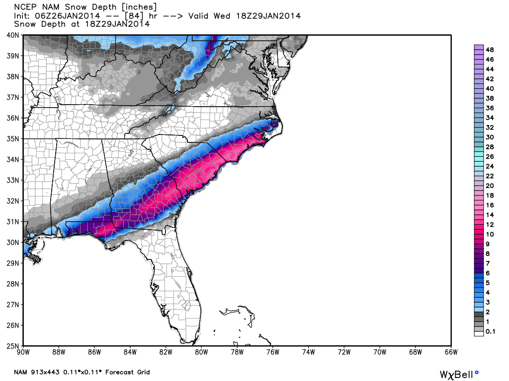
PLACEMENT: The NAM model suggests potential for up to two inches of snow along and south of a line from Mobile to Georgiana to to Troy to Phenix City. It hints at a remarkable 10 inches or more from Panama City Beach Florida to Charleston, SC and the lower Outer Banks of North Carolina. This seems overdone.
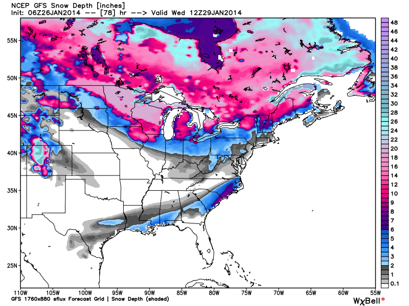
The GFS global model is very similar, just without the extreme snow amounts from Panama City to Charleston.
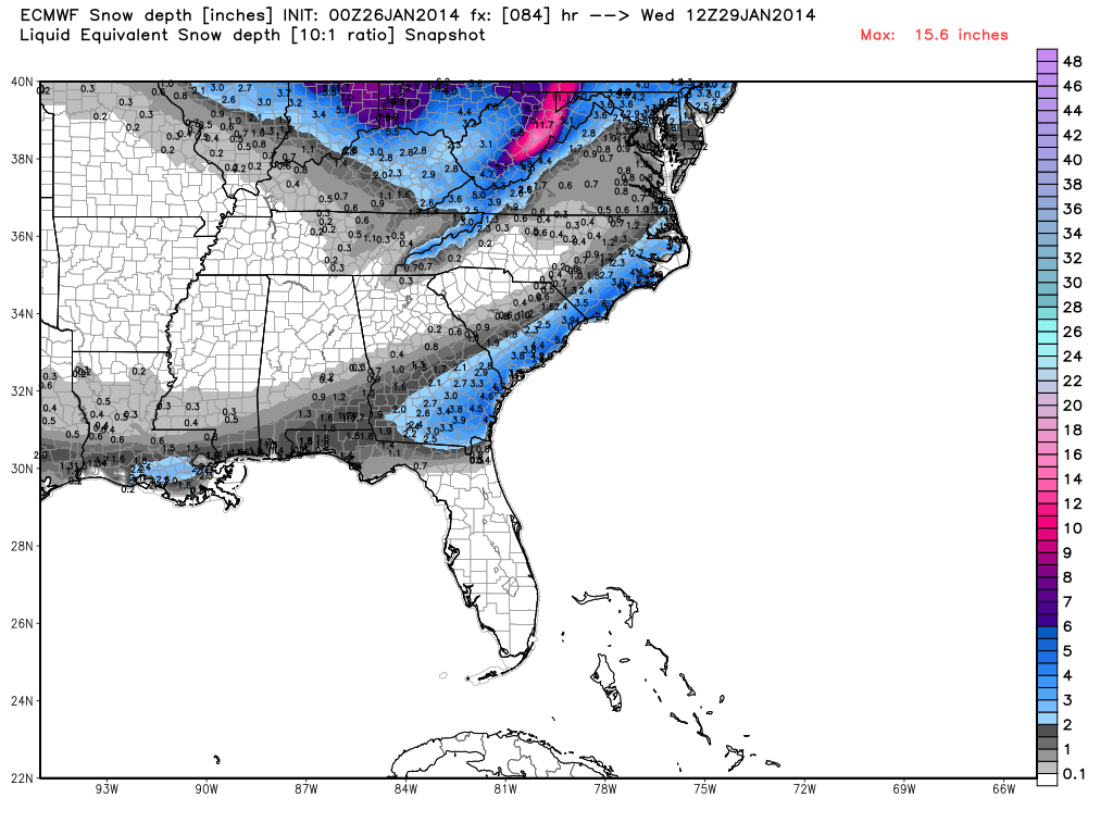
And, the European model is like the GFS, except that snow totals are a little lower.
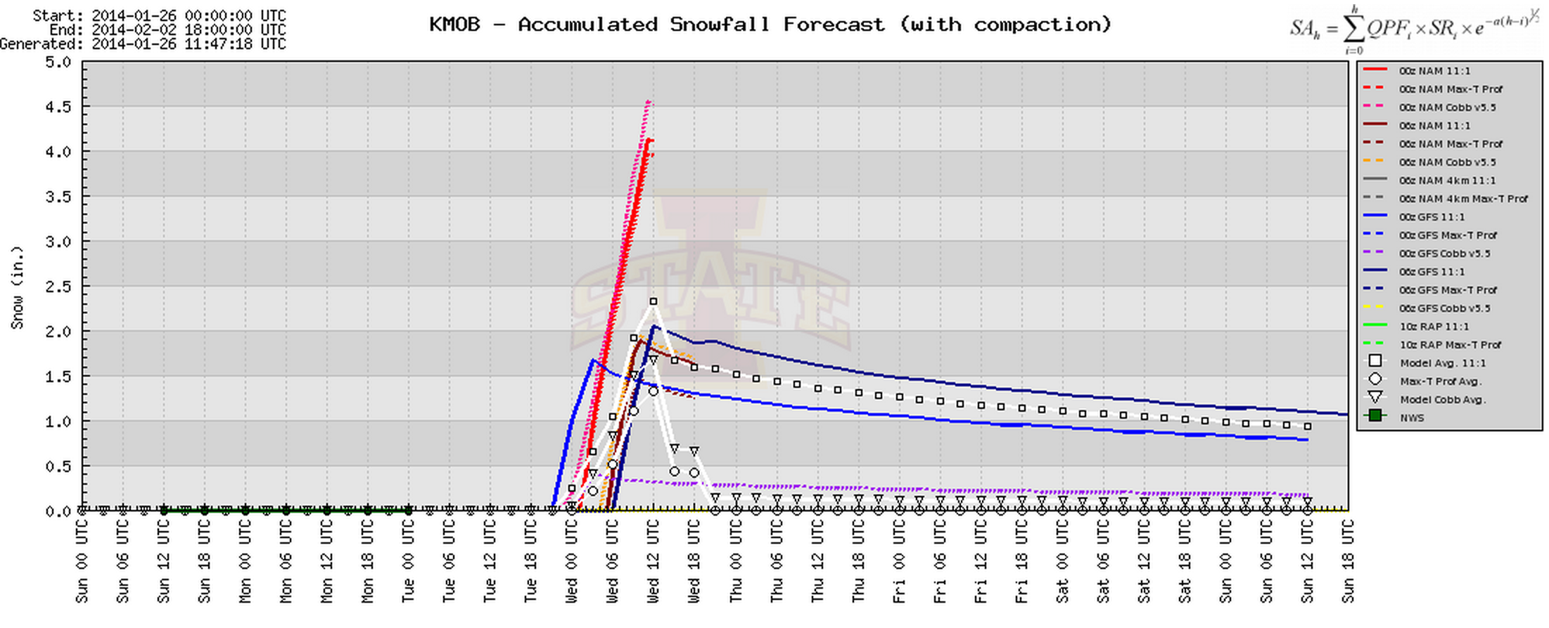
Interesting to note the BUFKIT snow analysis for Mobile. You don’t see this often…
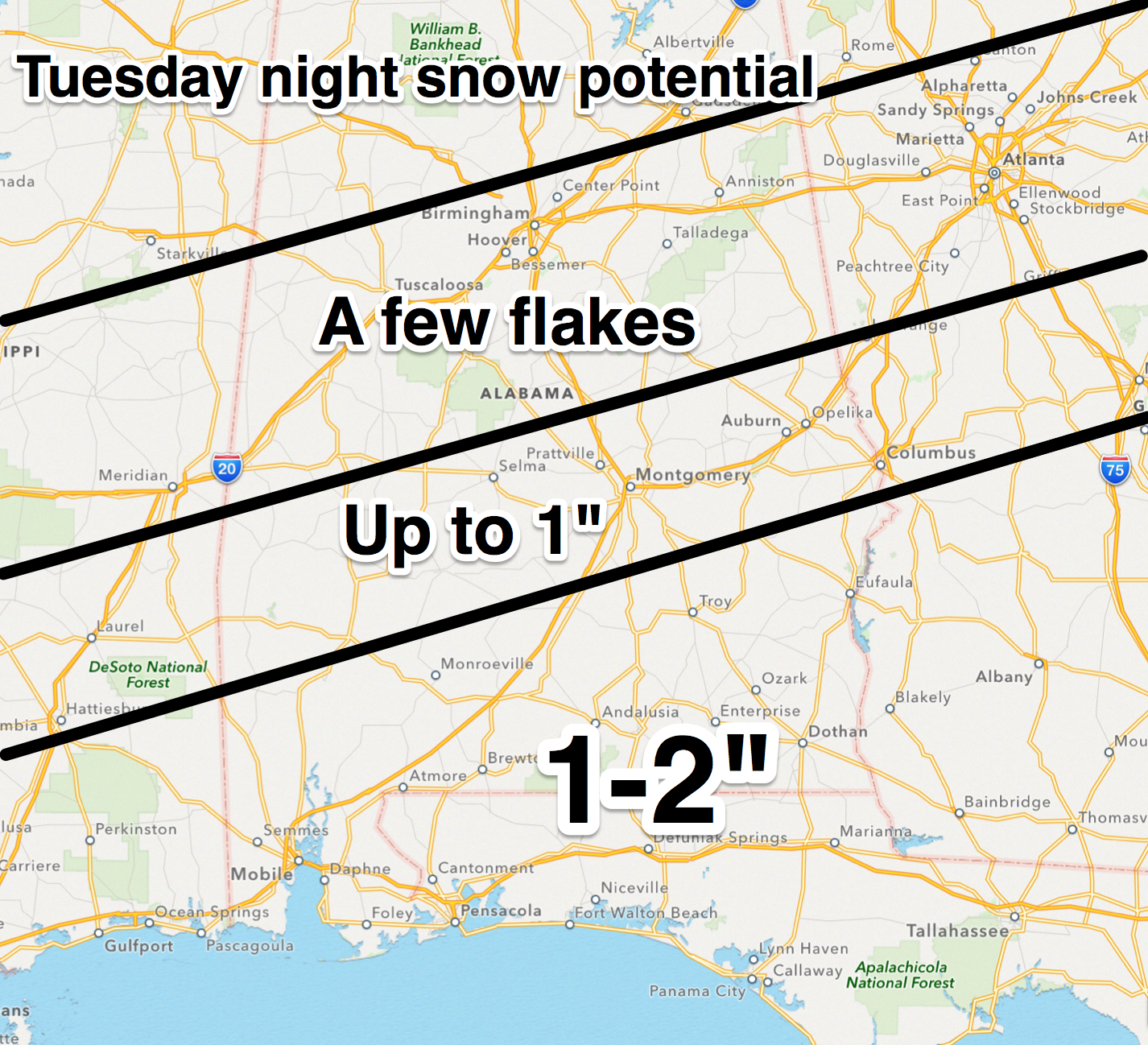
BOTTOM LINE: Understand this will change, but for now we project the potential for 1 to 2 inches of snow for South Alabama late Tuesday into early Wednesday, south of a line from Chatom to Greenville to Phenix City; potential for up to 1 inch as far north as Demopolis to Clanton to Roanoke, with just a few snow flakes as far north as I-20.
Some travel issues are possible Tuesday night over South Alabama… if you are headed that way be aware of the potential, but also understand this is very early in the forecasting process and that could change.
The the northern half of Alabama, the cold is the big deal, not snow. For those of you in South Alabama, stay tuned as this forecast no doubt will need to be adjusted over the next 36 hours. This is just a “first look” for planning purposes. There isn’t much skill in forecasting snow events over South Alabama since they simply don’t happen that often, and we don’t have too many analogs.
But, with any snow event in Alabama, you know there will surprises. Stay tuned…
Category: Alabama's Weather
About the Author (Author Profile)
James Spann is one of the most recognized and trusted television meteorologists in the industry. He holds the AMS CCM designation and television seals from the AMS and NWA. He is a past winner of the Broadcast Meteorologist of the Year from both professional organizations.Subscribe
If you enjoyed this article, subscribe to receive more just like it.


