Morning Model Looks
Here is a look at the solutions offered by our various model suites from this morning’s runs.
GFS Scenario
A few sprinkles or light showers tonight ahead of the cold front. Sleet breaks out in the cold air over Southeast Texas Monday night. Wintry precip will increase in coverage from southeastern Texas through Central Louisiana into western Mississippi and along the Gulf Coast from southeastern Louisiana to Alabama. Light snow will spread as far north as I-20 during the afternoon and a wintry mix of snow, sleet and freezing rain will become widespread along the Gulf Coast from Houston to New Orleans to Mobile and north to Demopolis, Montgomery and Roanoke. Light snow will continue generally north of the wintry mix area to I-20. The precipitation should start ending from the northwest during the early morning hours.
Under this scenario, a dusting of snow could accumulate in the I-20 corridor, with an inch south of a line from Eutaw to Calera to Lineville. The best chance for snowfall accumulation will be south of a line from Chatom to Greenville to Phenix City. 2-3 inches of snow could fall in this area all the way to the Gulf Coast. Of course, if there is more sleet or freezing rain, this could reduce the snow accumulation, but would not reduce the potential for travel problems.
Here is the GFS snow depth chart for Wednesday morning:
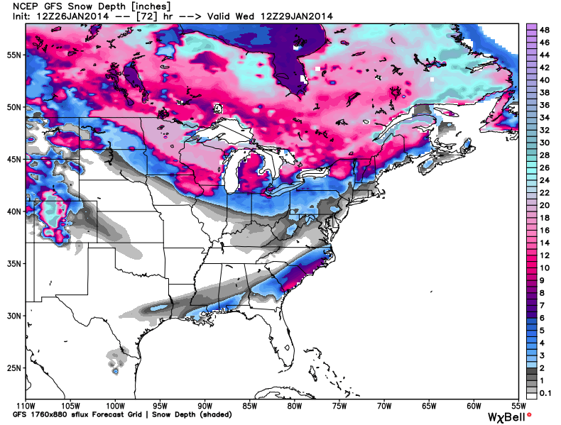
This output looks almost identical to the 06z run of the GFS.
NAM
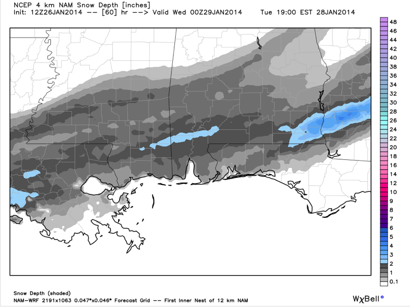
The NAM is similar in its solution of breaking out a wintry mix from southeastern Louisiana across the Mississippi, Alabama and Northwest Florida coasts into South Alabama. Light snow will overspread South Central Alabama south of a line from Demopolis to Clanton to Roanoke. Serious accumulation of sleet/freezing rain could occur with this scenario Tuesday and Tuesday night across far southern Alabama, including coastal sections.
Here is the NAM snowfall depth for Tuesday afternoon:
European
The European model is drier, forecasting around 0.10 inches of liquid equivalent from Houston across the southern half of Louisiana, the southern third of Mississippi/Alabama, the Florida Panhandle and into southern Georgia. Most of this would come in a wintry mix of rain, sleet, snow and freezing rain, changing to snow Tuesday night.
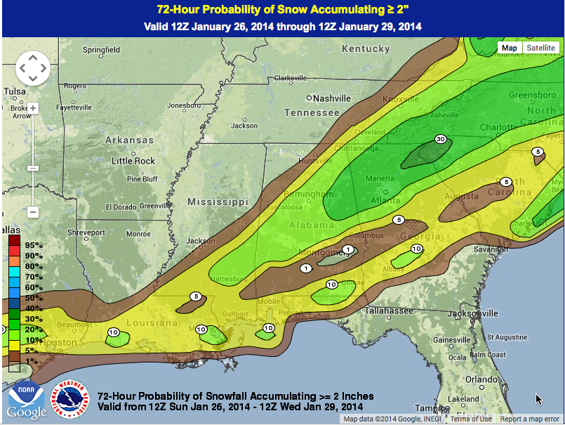
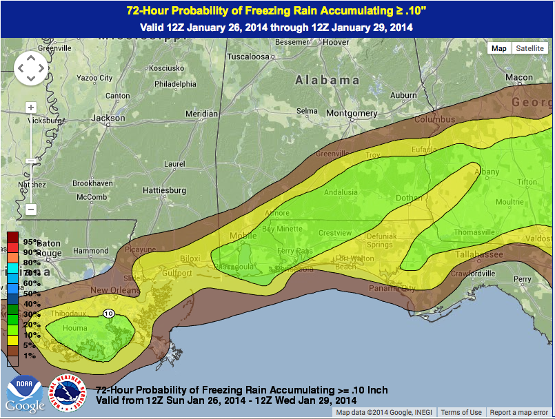
HPC Probabilistic Forecasts
The folks in Washington have the following probabilities in place over the next 72 for two inches or more of snow or 0.10 inch of freezing rain.
DEVELOPING SITUATION:
Needless to say, this is a developing winter weather situation. Folks planning travel anywhere along the Gulf coast from Houston across much of the southern half of Louisiana, southern Mississippi, southern Alabama and the Florida Panhandle from late Monday night through Wednesday should pay attention to future forecasts are make plans accordingly.
Category: Alabama's Weather
About the Author (Author Profile)
Bill Murray is the President of The Weather Factory. He is the site's official weather historian and a weekend forecaster. He also anchors the site's severe weather coverage. Bill Murray is the proud holder of National Weather Association Digital Seal #0001 @wxhistorianSubscribe
If you enjoyed this article, subscribe to receive more just like it.


