

Snow Tapering Off from West to East
Update: The Winter Weather Advisory for Sumter and Marengo counties has been cancelled as of 5:05 PM.
We continue to see light snow showers across Central Alabama this evening. The snow is rapidly moving east across the state. For West Alabama the snow is over, and West Alabama appears to be where the best snow totals have been. There was a dusting for much of Sumter County, and this heavier snow made it north into Greene, Hale, and southern Tuscaloosa counties.
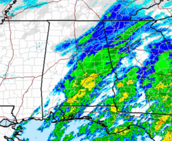
All snow continues to shift east, with the heaviest snow showers ongoing along the Interstate 65 corridor. The snow is over in Tuscaloosa, Demopolis, Livingston, and is beginning to end around Birmingham. Surface temps remain above freezing some no issues with road conditions will occur from this event. Across some of our southern counties it is mostly sleet falling this evening. Locations in and around Montgomery are reporting the ice pellets falling from the sky.Over the next few hours, the wintry precip will wind down over central and eastern Alabama as the precip shield moves off over into Georgia.
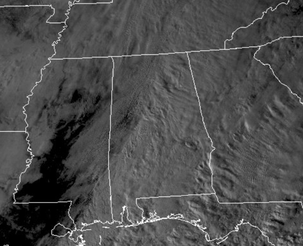
We have even had a few breaks in the clouds over West Alabama and that allow a few peeks of sunshine snow ended. We can see those breaks on the satellite image below. The clouds will be slow to clear tonight, but during the overnight hours we will see conditions improve and we will become partly cloudy. The sun will return for tomorrow and we will see some warmer afternoon highs as upper 40s are expected.
Category: Alabama's Weather, Winter Weather
About the Author (Author Profile)
Macon, Georgia Television Chief Meteorologist, Birmingham native, and long time Contributor on AlabamaWX. Stormchaser. I did not choose Weather, it chose Me. College Football Fanatic. @Ryan_StinnetSubscribe
If you enjoyed this article, subscribe to receive more just like it.


