Quick Update
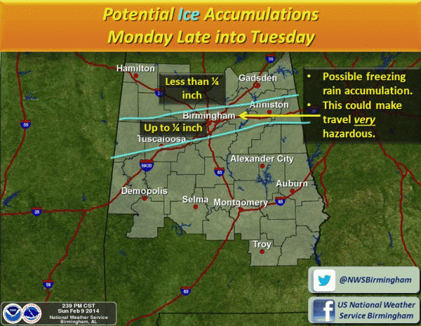
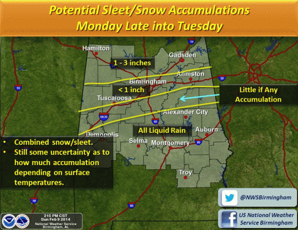
Not much change in the overall thinking. A significant winter storm will impact North Alabama late tomorrow night into Tuesday morning. The main threat for the I-20 cities (Birmingham, Tuscaloosa, Anniston) is from ice accumulation due to a wintry mix of freezing rain, sleet, and some snow.
The greater snow totals will be around the U.S. 278 corridor, north of Birmingham…
Scroll down through the various posts for much more information. The biggest forecast challenge will be on the southern periphery of the winter weather threat. Some will see a cold rain, while others will see enough ice for major travel impact and maybe even scattered power outages. More updates here on the blog shortly. Stay tuned…
Category: Alabama's Weather


