

A Nice Afternoon Ahead of the Storm
Click image to enlarge.
Lost in the shuffle with all the talk about the impending winter storm event is the fact that a beautiful day is in progress across MUCH of Central and South Alabama.
Areas along and south of I-59 have abundant sunshine and temperatures well into the 50s and 60s. At 1 p.m., it was 58F at Tuscaloosa, Birmingham and the Shelby County Airport. It was 59F at Anniston. People are working on their tans in Mobile and Greenville, where it is 65F.
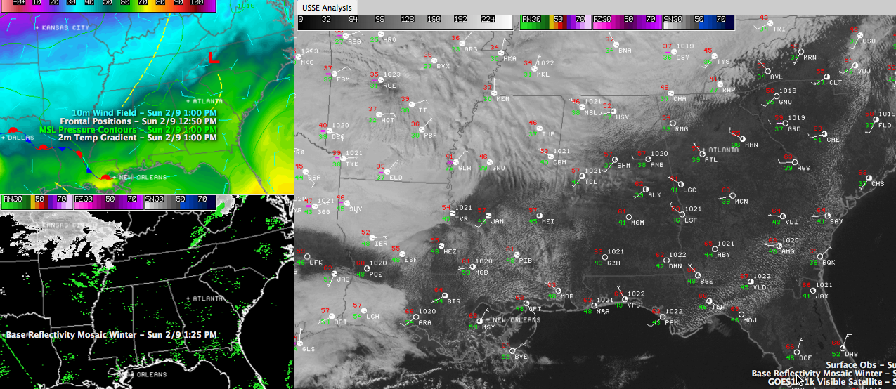
You can see a wide variety in temperatures across Alabama on the upper left panel of the graphic though. You might expect to find a front there. Looking at the analysis you find a surface trough pushing eastward. As it does, a cold front will get organized in its wake and the colder airmass will start spilling southeastward as well.
Thick clouds associated with the trough blanket Northwest Alabama where it is just 47F at Muscle Shoals.
The front will reach the I-20 corridor this evening and I-85 by tomorrow morning. And then the headaches will begin as a surface low forms to the southwest and tracks eastward.
Ryan Stinnett is working hard on an afternoon forecast update and he will post some of his notes here shortly.
Category: Alabama's Weather
About the Author (Author Profile)
Bill Murray is the President of The Weather Factory. He is the site's official weather historian and a weekend forecaster. He also anchors the site's severe weather coverage. Bill Murray is the proud holder of National Weather Association Digital Seal #0001 @wxhistorianSubscribe
If you enjoyed this article, subscribe to receive more just like it.


