Early Afternoon Notes
A few quick notes…
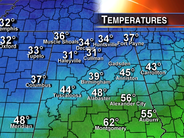
*A little light freezing rain and sleet is over North Alabama at midday. This precipitation is very light, but temperatures are below freezing in a few spots, so a little patchy ice on bridges is not totally out of the question over the next few hours. But, no widespread problems are expected, and I have heard of no issues so far. There will be no travel problems at all for Tuscaloosa, Birmingham, and Anniston today.
*A large mass of precipitation will move into Alabama late tonight, generally after midnight. Some freezing rain is possible over Northwest Alabama as early as 10:00 p.m., but for most places we do not anticipate any travel issues until after midnight.
*Computer models are not handling thermal fields well. It is much colder than forecast today over North Alabama; the air we are seeing is coming over a big snowpack north of the state, and it will be cold tonight. Colder than model guidance for sure.
*There is growing concern over ice accumulation potential along and just north of I-20 late tonight and tomorrow morning. Ice to 1/4″ is very possible, and this could lead to scattered power outages and very dangerous driving conditions on bridges and overpasses. Some black top roads could also have some patchy ice accumulation. The NWS in Birmingham will most likely upgrade the “winter weather advisory” to a “winter storm warning” shortly for North-Central Alabama, including the cities of Birmingham, Tuscaloosa, Anniston, and Gadsden.
*Accumulating snow is likely near the U.S. 278 corridor (Hamilton to Cullman to Gadsden). Some places will see 1 to 2 inches; isolated amounts to three inches are possible. Some sleet and freezing rain could be in the mix there as well. Travel will be come hazardous.
*Remember, there will be a sharp cut-off between freezing rain and ice areas, and just a cold rain. This will probably near or just south of I-20; it is possible parts of Tuscaloosa, Birmingham, and Anniston will have a cold rain with 33 degrees, while other parts of these cities have ice with 30 degrees.
*There is also growing concern that some places will have a hard time rising above freezing tomorrow; this could keep driving conditions in bad shape into the afternoon in places.
*The “second wave” tomorrow night into Wednesday morning has high potential to create more freezing rain over East-Central and Northeast Alabama due to the CAD effect (cold air damming). Colder air will drain into Alabama from the east, and a considerable amount of freezing rain is likely for counties like Cherokee, Cleburne, and Randolph. Possibly counties west of there as well. This wave could result in more widespread power outages over far East Alabama due to ice load, and has a high percentage impacting Atlanta and much of North/Central Georgia as well.
I will have a full update on the blog with a fresh Weather Xtreme video a little later this afternoon. Stay tuned.
Category: Alabama's Weather
About the Author (Author Profile)
James Spann is one of the most recognized and trusted television meteorologists in the industry. He holds the AMS CCM designation and television seals from the AMS and NWA. He is a past winner of the Broadcast Meteorologist of the Year from both professional organizations.Subscribe
If you enjoyed this article, subscribe to receive more just like it.


