Possible Upgrade to a Winter Storm Warning for Tonight
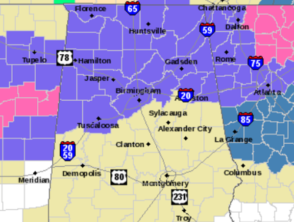
The National Weather Service is currently deciding whether or not to upgrade the Winter Weather Advisory for Central Alabama to a Winter Storm Warning. They have also expressed interest in expanding a Winter Weather Advisory to the south one row of counties. This would most likely include Shelby, Talladega, Clay, Randolph, Bibb, Greene, and Hale Counties. Here is the current advisory map, all counties currently shaded in purple would be expected to be included in the upgrade and that would be it in line with the Winter Storm Warning to our west.
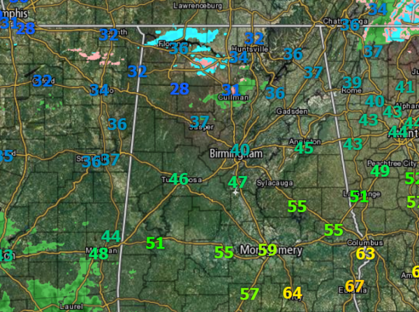
The freezing line is currently running along and just south of the U.S. 278 corridor from Haleyville to Cullman.The surface temps are not warming as much as expected today, Birmingham’s temp is 3-5 degrees lower than forecast model data. That means it should be colder overnight and will make it easier for us to reach freezing mark overnight. The freezing line will be a little farther south than first thought during the overnight hours.
This does not bode well for the Interstate 20 corridor. The uncertainty of the placement of the freezing line has been the hardest part with this system. We knew it would be close to the Interstate 20 corridor and that a swing of a few miles across the area could mean an all rain event, all freezing rain, or totally frozen precip. The thought now is the freezing line will be just to the south of this area, which could be the area in the prime area for freezing rain.
At the 850MB level of the atmosphere, a trough will be moving through overnight and it will cause an enhancement over the area and cause heavier precip totals. The models are showing there could be additional moisture over the state. With the possibility of higher accumulations a warning is likely necessary compared to the advisory.
There is a better chance of seeing a rain/freezing rain mix a little farther south as well and is why the advisory was issued for those counties.
To the south, Selma, Montgomery, Troy, and Auburn, this still appears to be an all rain event for you.
Tomorrow morning will be very interesting. I recommend that you make no plans to go anywhere and to wait this event out. Road conditions will not be ideal and travel will be impacted.
Another look at the radar shows we are seeing returns in areas of northern Alabama. We are hearing reports of snowflakes and sleet across our northern counties and we can see that showing up on radar. Locations Winston, Lawrence, Lauderdale and Cullman counties are where we are seeing this precip. We will continue to see showers increase across the area today and tonight as the temps drop this is when Central Alabama will begin to see the transition to wintry precip.
Category: Alabama's Weather, Winter Weather
About the Author (Author Profile)
Macon, Georgia Television Chief Meteorologist, Birmingham native, and long time Contributor on AlabamaWX. Stormchaser. I did not choose Weather, it chose Me. College Football Fanatic. @Ryan_StinnetSubscribe
If you enjoyed this article, subscribe to receive more just like it.


