Quick Radar Check
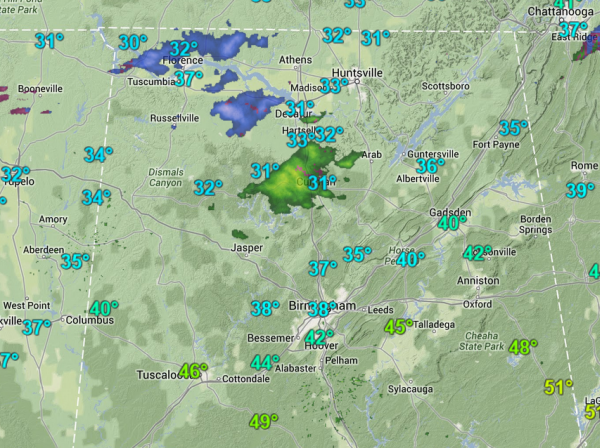
Much of Central Alabama remains dry, just socked in with clouds and cool temperatures. We are now in the waiting game and we are watching a few radar returns to our north as large snowflakes, sleet, freezing rain and rain are being reported along areas of U.S. 278. We are seeing descent radar returns over Cullman and Winston counties. Social media is a buzz with the pocket of precip moving east across the state. Light snow and sleet are also being reported over northwestern portions of the state. In both these areas, there are currently no reports of travel impacts or poor road conditions.
Throughout the rest of the afternoon, we will see more showers develop and move into the state. Temps are above freezing in Central Alabama and they are expected to stay above it until this evening. We are working on additional blog posts currently and we have them ready soon.
Category: Alabama's Weather, Winter Weather
About the Author (Author Profile)
Macon, Georgia Television Chief Meteorologist, Birmingham native, and long time Contributor on AlabamaWX. Stormchaser. I did not choose Weather, it chose Me. College Football Fanatic. @Ryan_StinnetSubscribe
If you enjoyed this article, subscribe to receive more just like it.


