

11 p.m. Update
We have been receiving lots of reports tonight of sleet and some snow in North Alabama generally in the US-278 corridor across Marion, Winston, Cullman, Blount and Etowah Counties.
Light to moderate sleet in Cullman has changed over to large snowflakes says Huntsville TV met Jennifer Watson.
Temperatures now in that area are in the lower 30s. It is 32F at Huntsville and 33F at Muscle Shoals. Other reports include 30F at Haleyville and 31F at Decatur. It is 31F at Cullman and 32F at Fort Payne.
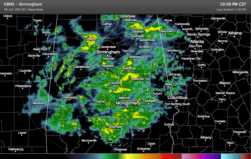
Radar indicates a wintry mix of rain, snow and sleet is falling from Cullman to north of Oneonta and Ashville to near Piedmont across Cullman, Blount, Etowah and into Calhoun and Cherokee Counties. It is 35F in Gadsden and 32F in Boaz.
A mix of snow, sleet and rain is falling over much of Fayette County from south of Carbon Hill in Walker County to between Fayette and Berry.
Both of these areas feature bright banding (high reflectivity) on the radar, generally indicative of melting snow or large sleet.
Temperatures will continue to drop across the area overnight, reaching I-20 after 3 a.m. As temperatures drop, sleet, snow and freezing rain will increase, causing problem on area roads. The freezing conditions will last until mid-morning at least in the 20 corridor. If they last longer, if will make the icing situation worse.
REPORTS
…Sleet and snow mix in Nauvoo 32F.
…Snow accumulating on exposed surfaces in Cullman.
…Snow accumulating on the Walker/Winston County line.
…Sleeting in Cleveland AL.
…Heavy sleet in Hokes Bluff with a glaze on decks.
…Sleet falling in Gadsden.
…Good sleet in Jasper.
WARNINGS/ADVISORIES
A winter storm warning remains in effect Blount, Calhoun, Cherokee, Cleburne, Etowah, Fayette, Jefferson, Lamar, Marion, Pickens, St. Clair, Tuscaloosa, Walker and Winston Counties until early Thursday.
1 to 3 inches of snow will fall north of a line from Fayette to Jasper to Oneonta to Gadsden through tomorrow morning. Up to .20 inches of freezing rain will occur north of a line from ALiceville to north of Tuscaloosa to Birmingham and Anniston through mid-morning. These accumulations will cause significant haxards to travel.
IF YOU ARE IN THE WINTER STORM WARNING AREA, DO NOT DRIVE AFTER MIDNIGHT.
Winter Weather Advisory is in effect for Bibb, Clay, Greene, Hale, Randolph, Shelby, Sumter and Talladega Counties until early Thursday. Southward to a line from Boligee to Jemison to Roanoke, a tenth of an inch of ice may accumulate on roads, especially bridges and overpasses.
Check road conditions before traveling in the advisory area.
This is just the first round — the second round will come Tuesday night into Wednesday.
Category: Alabama's Weather, Winter Weather
About the Author (Author Profile)
Bill Murray is the President of The Weather Factory. He is the site's official weather historian and a weekend forecaster. He also anchors the site's severe weather coverage. Bill Murray is the proud holder of National Weather Association Digital Seal #0001 @wxhistorianSubscribe
If you enjoyed this article, subscribe to receive more just like it.


