

Forecast on Track
Good news just across the state line, the NWS in Jackson has cancelled the Winter Weather Advisory for the counties that border Alabama as temperatures have warmed above freezing and only light to moderate rain is falling.
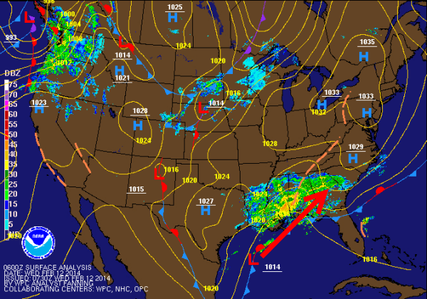
That is not the case in southwestern Mississippi and northern Louisiana as quite the ice situation developed overnight. Interstate 20 has ice accumulations and there are power outages throughout the area. Many areas are reporting more than a quarter inch of ice covering everything, including utility lines and bridges.
Much better conditions in Alabama as warm air advection helped keep our temperatures up as well delivered more moisture into the region. Across Alabama, we are seeing varying weather conditions for the northern part of the state. For areas along and south of I-20, it is all rain. No winter weather concerns this morning. Actually a descent distance north of here, conditions are okay as well. Where we are seeing a wintry mix and some icing is along and north of the U.S. 278 corridor. There have been several reports of freezing rain in these locations as icing is occurring on elevated surfaces as well as a light coatings of ice reported on cars, houses, signs, and utility lines. Similar reports across the Tennessee Valley of Alabama as well. If you have to travel in these areas, use caution as there will be some click spots and make sure you check local road conditions.
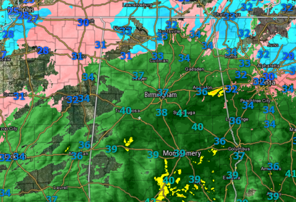
For the next couple of hours, I think what we see is what we get. Most of us should see a cold rain today as temps should stay above freezing, before we begin to transition to a winter weather threat, especially for northern and eastern portions of the state. Even though we have seen some advisories dropped to our west, the main window of concern for Alabama will occur later today and all winter weather alerts in effect are for later today.
Low pressure along the Gulf Coast will be moving inland. The low will pull down so colder air from the north. We will have overrunning precip and the rain will transition to snow later today. I expect that locations near Birmingham will see snow, but the real concern will be east of there. Heavy snow accumulations and a threat for icing could cause serious issues over eastern portions of the state as cold air damming will be moving in from the east.
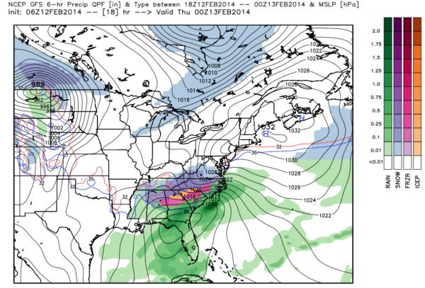
Since the GFS has the best hold of the system lets look at the forecast graphic for the later today. We see the majority of our precip has switched over to snow. The snow will develop over the Tennessee Valley by early afternoon and then spread south throughout the day as colder air is pulled south on the back side of the low.
Below is a graphic of possible accumulations put out by the National Weather Service. This seems to best align with the overall thinking and model agreement for potential accumulations. Of course, there is usually always a surprise when it comes to winter weather forecasting and that surprise could be some locations receiving more accumulations than are forecast.
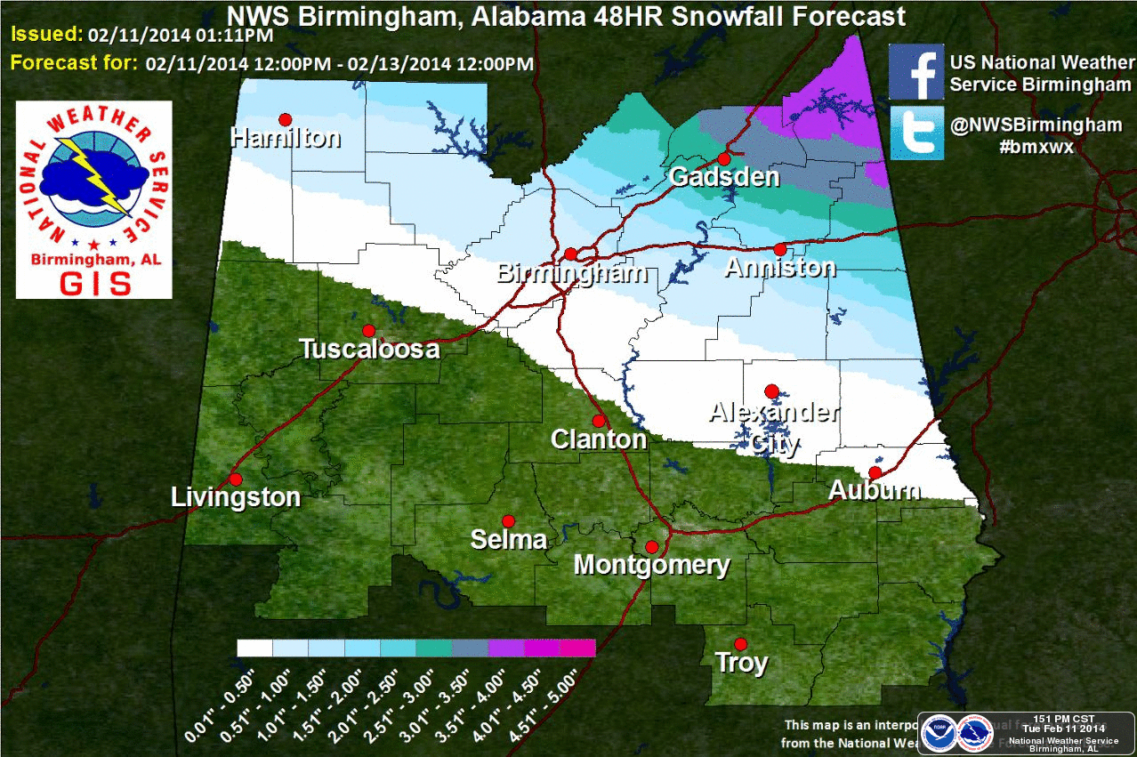
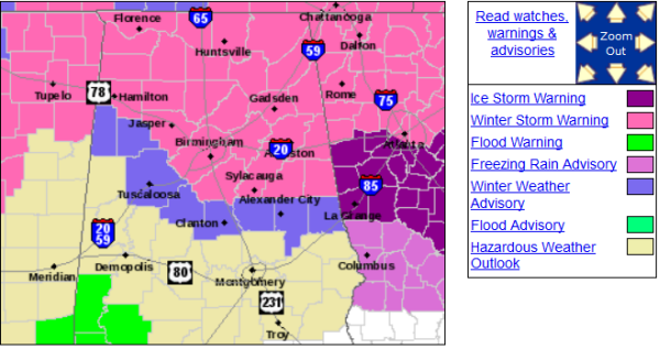
A quick reminder of the alerts issued for Alabama. The Winter Storm Warning and Winter Weather Advisory remain valid until 6AM Thursday. Though road conditions appear fine this morning in Central Alabama, these are likely to change through the day as a majority of our precip goes from liquid to frozen. Make sure you stay up-to-date on the latest weather and road conditions as we head through the day.
Category: Alabama's Weather, Winter Weather
About the Author (Author Profile)
Macon, Georgia Television Chief Meteorologist, Birmingham native, and long time Contributor on AlabamaWX. Stormchaser. I did not choose Weather, it chose Me. College Football Fanatic. @Ryan_StinnetSubscribe
If you enjoyed this article, subscribe to receive more just like it.


