Storm Ramping Up
A few notes… we can clearly now see the deformation axis, which will coincide with the band of heavier snow, setting over Central MS… this rotate into North Alabama this afternoon and early tonight. Snow forecast amounts will need to be ramped up a bit in the winter storm warning area. New update out soon, but we might need to mention 2-3 inches for the B’ham metro now.
We also are looking at mentioning snow potential for Tuscaloosa later this afternoon as well. In fact, the NWS is considering expanding the winter storm warning for counties like Pickens, Fayette, Lamar, and Tuscaloosa…
Road conditions will begin to deteriorate over North/East Alabama during the next 3 hours. Initially bridge icing, then black top roads could become snow/ice covered.
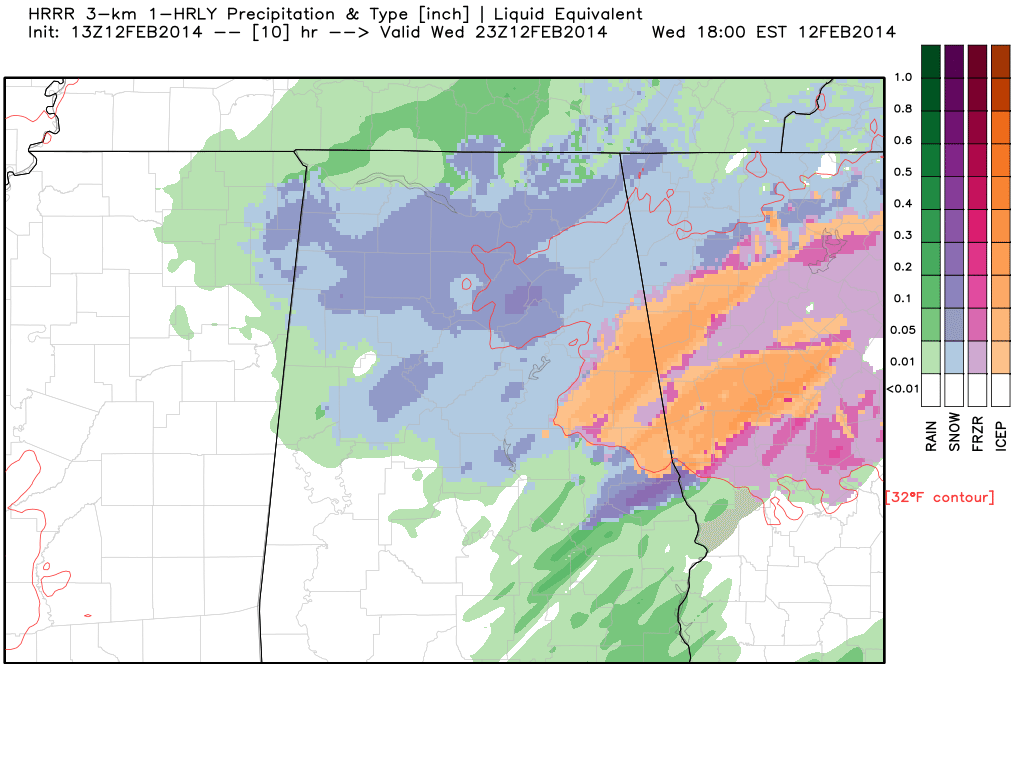
Here is HRRR model output valid at 5 p.m.
More shortly, but understand travel conditions will worsen across the northern half of Alabama between now and 3 p.m.
Category: Alabama's Weather
About the Author (Author Profile)
James Spann is one of the most recognized and trusted television meteorologists in the industry. He holds the AMS CCM designation and television seals from the AMS and NWA. He is a past winner of the Broadcast Meteorologist of the Year from both professional organizations.Subscribe
If you enjoyed this article, subscribe to receive more just like it.


