

Things Calming a Bit
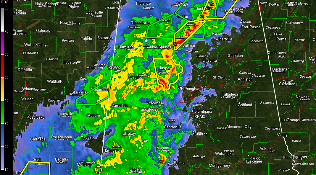
Only one warning in the Birmingham NWS area of responsibility. It is a severe thunderstorm warning for Walker County. Even that storm has weakened a bit in the past few minutes.
There still is a severe thunderstorm warning for northwestern Cullman County and Morgan County.
Radar indicates the strongest storms are from Double Springs to Jasper and Parrish.
Torrential rain, winds to over 50 mph and small hail are still possible with this storm.
It is moving east northeast and will affect southern Cullman, Blount and northern Jefferson Counties.
Elsewhere, moderate to heavy rains covered a large part of the area from Marion and Winston Counties southward through Lamar, Fayette and Walker Counties into Pickens, Greene and Hale Counties.
All this activity will push east northeast for the next several hours.
We will continue to track stronger actvity in South Central Mississippi that will push into South Central Alabama over the next few hours.
A tornado watch remains in effect for much of North, Central and Southwest Alabama until the early morning hours.
Category: Alabama's Weather, Severe Weather
About the Author (Author Profile)
Bill Murray is the President of The Weather Factory. He is the site's official weather historian and a weekend forecaster. He also anchors the site's severe weather coverage. Bill Murray is the proud holder of National Weather Association Digital Seal #0001 @wxhistorianSubscribe
If you enjoyed this article, subscribe to receive more just like it.


