Warmer Tomorrow; Rain Returns This Weekend
An all new edition of the ABC 33/40 Weather Xtreme video is available in the player on the right sidebar of the blog. You can subscribe to the Weather Xtreme video on iTunes by clicking here.
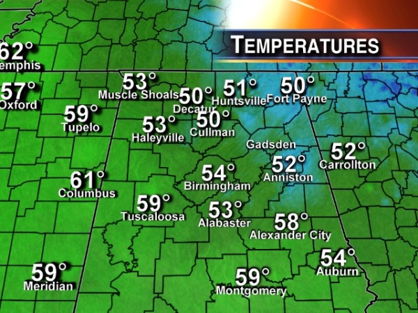
ANOTHER CHILLY NIGHT AHEAD: Despite sunshine in full supply, temperatures are only in the low to mid 50s over North/Central Alabama this afternoon, well below the average high of 66 degrees for March 13. Tonight will feature another chill; most communities will see a low in the mid 30s early tomorrow, and the colder pockets will see another freeze.
Tomorrow will be dry and warmer; with a partly sunny sky we will reach the mid to upper 60s. Clouds thicken tomorrow night.
WEEKEND RAIN: The news is better if you are planning something outdoors during the day Saturday. The 12Z model set has come in slower with the rain, suggesting the main event will be Saturday night into Sunday. We will still mention the risk of a shower or two during the day Saturday, but it sure looks like a pretty decent part of the day will be dry. The sky will be mostly cloudy Saturday, and the high will be in the mid 60s.
Rain and a few thunderstorms are likely late Saturday night into the day Sunday… seems like the main window for the most widespread rain will come from midnight Saturday night through about 3:00 p.m. Sunday. There will be some surface based instability, but the forecast wind fields and shear values suggest severe weather won’t be an issue, although SPC does have the standard “slight risk” up during the day Saturday for parts of East Texas and Southwest Louisiana.
FORECAST CHANGES FOR MONDAY: Both the 12Z GFS and the 12Z European run now show a secondary surface low moving through Alabama Monday, and we will amend the forecast to include a chance of rain, and possibly a thunderstorm with this feature. Rain amounts between Saturday night and Monday night will be around two inches for most North/Central Alabama communities.
REST OF NEXT WEEK: The period Tuesday through Friday looks mostly dry, although a surface front might touch off a shower over far North Alabama Tuesday night. Looks like highs will be mostly in the 60s, with lows in the 40s, although we should reach the 30s early Thursday morning. See the Weather Xtreme video for the maps, graphics, and details.
WEATHER BRAINS: Don’t forget you can listen to our weekly 90 minute netcast anytime on the web, or on iTunes. This is the show all about weather featuring many familiar voices, including our meteorologists here at ABC 33/40.
CONNECT: You can find me on all of the major social networks…
Facebook
Twitter
Google Plus
Instagram
I enjoyed seeing the pre-school students today at Valley View Baptist Church in Leeds… be watching for them on the Pepsi KIDCAM today at 5:00 on ABC 33/40 News! Look for the next Weather Xtreme video here by 7:00 a.m. tomorrow…
Category: Alabama's Weather


