Clear Skies, A Cold Night
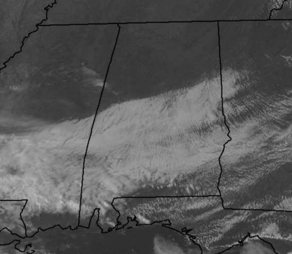
The skies have been slowly clearing from north to south across the state today. Most areas along and north of Interstate 20 are seeing severe clear, with a bright blue sky. Not at all a bad looking Sunday afternoon and evening across Alabama. South of there, still quite a bit of cloud cover for central and southern portions of the state.
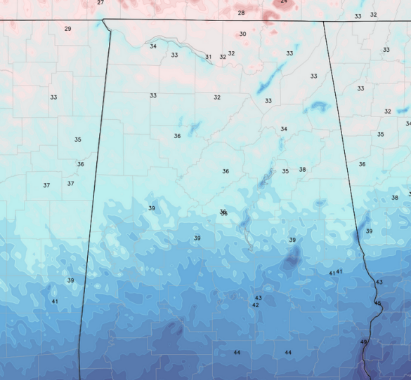
As we head into the overnight hours, with a new air mass in place, clear skies and a light wind, our temperatures will be cold. Looking at model data for early tomorrow morning, we see most locations across Central Alabama will be in the mid-30s by tomorrow morning. Locations in our northern counties will be at the freezing mark.
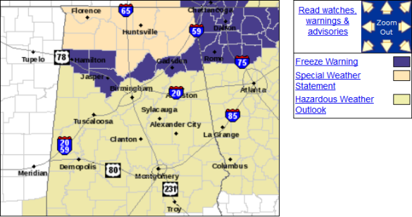
Because of the freezing threat for some areas, the National Weather Service in Birmingham has issued a freeze warning across the northern counties of the CWA. This won’t be the only time this week a freeze warning will be needed. A polar front will slide through the state late Monday night and will bring very cold air in for Tuesday night. The northern three-quarters of Alabama will likely see a freeze Wednesday morning as mid-20s are expected.
…FREEZING TEMPERATURES POSSIBLE TONIGHT ACROSS NORTHERN PORTIONS
OF CENTRAL ALABAMA…
THE COUNTIES THAT WILL BE IMPACTED ARE:
MARION, WINSTON, WALKER, BLOUNT, ETOWAH, CHEROKEE
INCLUDING THE CITIES OF…HAMILTON…DOUBLE SPRINGS…JASPER…
ONEONTA…GADSDEN…CENTRE
…FREEZE WARNING IN EFFECT FROM 1 AM TO 8 AM CDT MONDAY…
THE NATIONAL WEATHER SERVICE IN BIRMINGHAM HAS ISSUED A FREEZE
WARNING…WHICH IS IN EFFECT FROM 1 AM TO 8 AM CDT MONDAY.
* TEMPERATURES…UPPER 20S TO LOWER 30S.
* IMPACTS…TEMPERATURES AT OR BELOW FREEZING MAY DAMAGE OR KILL
BUDDING VEGETATION.
PRECAUTIONARY/PREPAREDNESS ACTIONS…
A FREEZE WARNING MEANS SUB-FREEZING TEMPERATURES ARE FORECAST TO
THREATEN OUTDOOR PLANTS. PRECAUTIONS SHOULD BE TAKEN TO HELP
PROTECT TENDER VEGETATION.
Category: Alabama's Weather
About the Author (Author Profile)
Macon, Georgia Television Chief Meteorologist, Birmingham native, and long time Contributor on AlabamaWX. Stormchaser. I did not choose Weather, it chose Me. College Football Fanatic. @Ryan_StinnetSubscribe
If you enjoyed this article, subscribe to receive more just like it.


