Radar and Satellite of Dolly
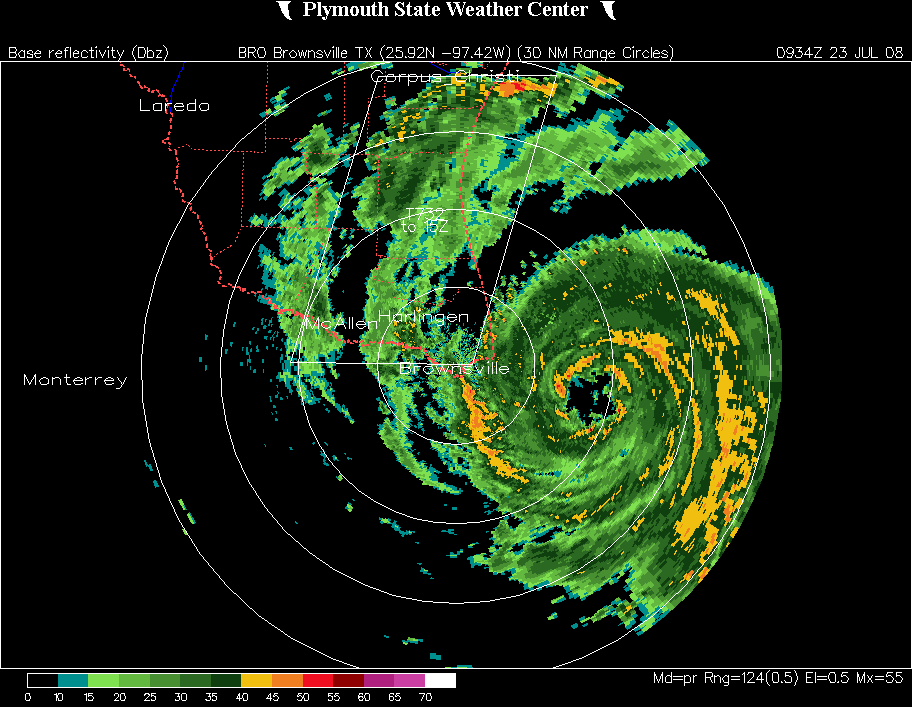
I have put together a long radar reflectivity loop of Hurricane Dolly, from 5 am through 1 pm, about the time Dolly made landfall on South Padre Island, Texas. Images from Plymouth State Weather Center.
Below is an animation of MIMIC images, morphed satellite images from CIMMS at the University of Wisconsin which show areas of deep convection (lots of water) because it attenuates the signal coming from low in the atmosphere. The more water in the atmosphere, the lower the energy reaching the satellite from low levels.

Category: Uncategorized
About the Author (Author Profile)
Subscribe
If you enjoyed this article, subscribe to receive more just like it.


