An Impressive Radar SIgnature
A mesolow over eastern North Carolina has looked very impressive and has produced numerous reports of wind damage and tornadoes this afternoon and evening.
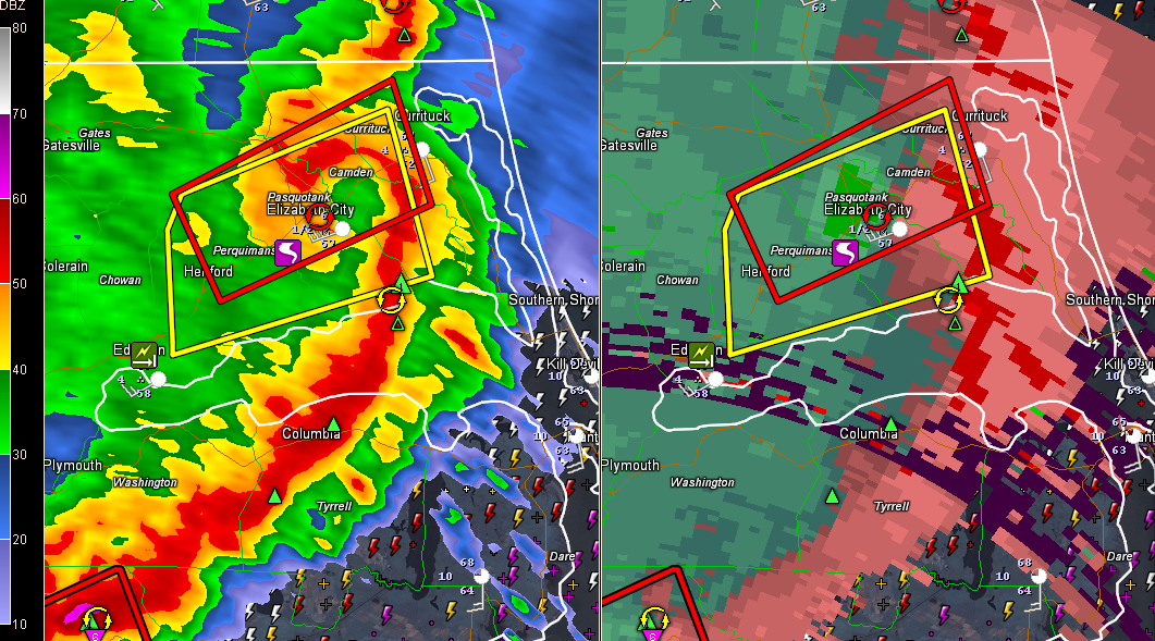
This radar image is from 7:13 p.m. CDT as the high precipitation supercell was near Elizabeth City. A couple of minutes later, it produced a wind gust to 64 mph at the airport there.
A possible tornado was reported near Pasquotank, NC at 7:07 p.m. There was a report of a tornado heading into the town via police scanner a short time later.
Widespread trees were reported down at Edneton, NC. at 6:35 p.m.
There have been 9 tornado reports in North Carolina today, with 21 reports of wind damage and 35 reports of large hail.
There have been some Twitter images of pretty significant tornado damage near Chicod NC.
The storms are hitting the brick wall though as they approach the cooler air near the coast.
Category: Headlines, Severe Weather
About the Author (Author Profile)
Bill Murray is the President of The Weather Factory. He is the site's official weather historian and a weekend forecaster. He also anchors the site's severe weather coverage. Bill Murray is the proud holder of National Weather Association Digital Seal #0001 @wxhistorianSubscribe
If you enjoyed this article, subscribe to receive more just like it.


