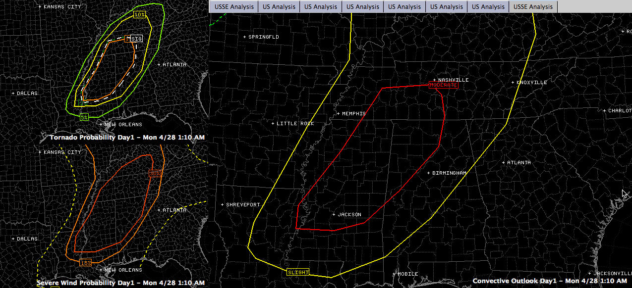
SPC Issues Moderate Risk for Alabama for Today
The new SPC Day One Severe Weather Outlook is out and it has much of the northwestern quarter of Alabama in an enhanced or moderate risk for severe weather today.
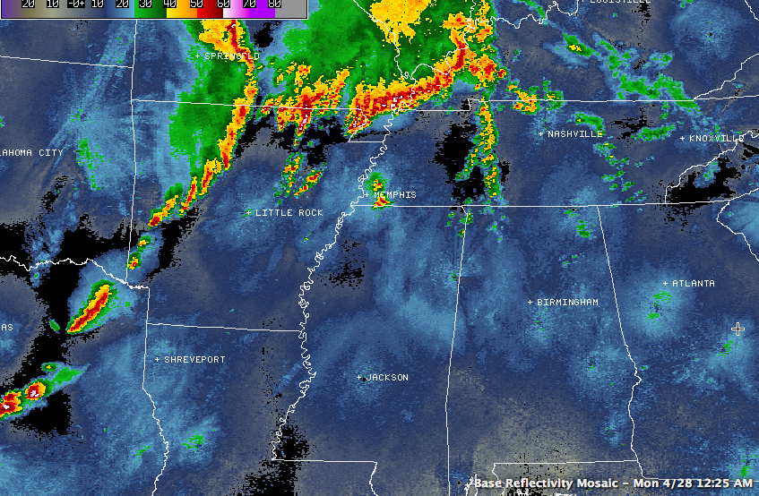
Early this morning, regional radars show widespread thunderstorms over western Kentucky and southeastern Missouri associated with an upper level disturbance near the Ohio River near Evansville IN.
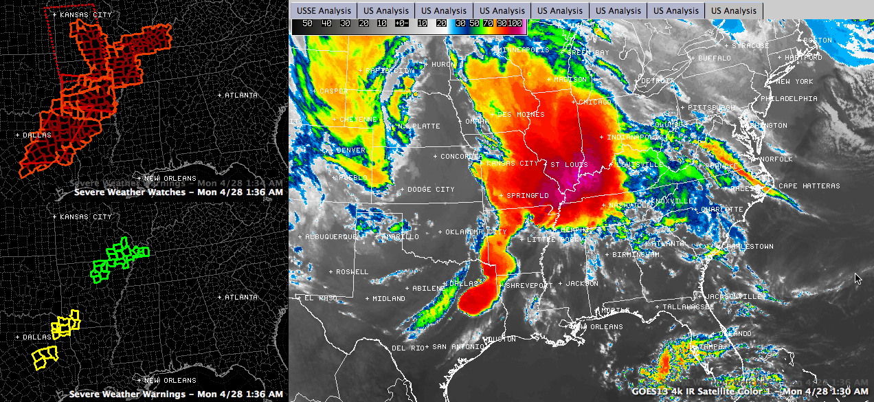
Numerous tornado watches are in effect. There are severe thunderstorm warnings in Texas right now as well.
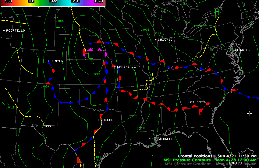
At the surface we find a strong (987 mb) surface low over southern Nebraska. This low has peaked and is now weakening.
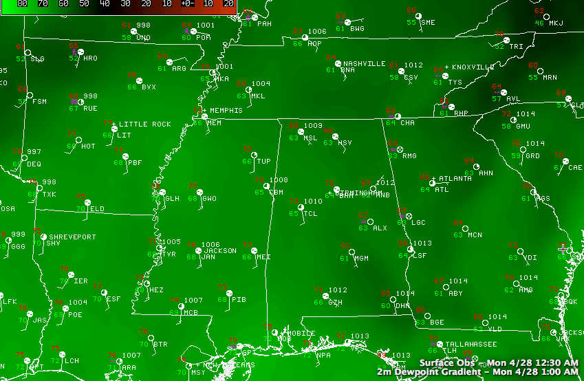
We are squarely in the warm sector of this low pressure system, and warm, moist air is in place. Dewpoints are in the middle 60 across Central Alabama with upper 60s over Central Mississippi.
Colder air aloft is spreading eastward in association with the upper low and trough to our west. The upper low over Nebraska early this morning.
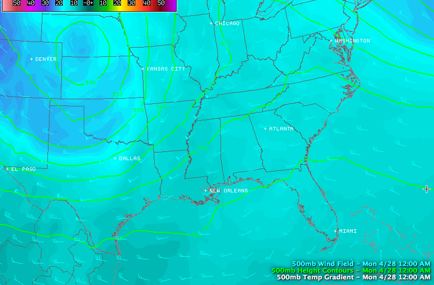
At 500 mb (18,000 feet), strong winds have rounded the base of the upper low over Nebraska. This first area of very strong winds aloft helped to produce the deadly tornadoes last night over Arkansas.
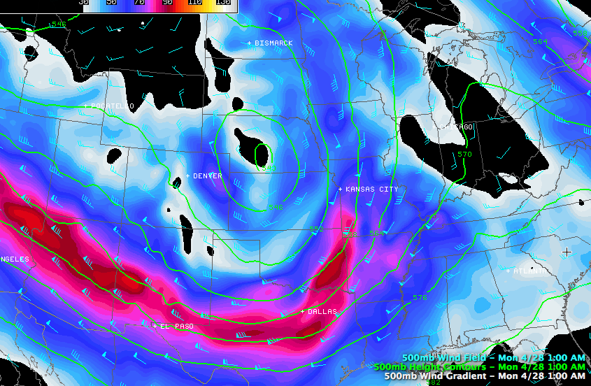
Another disturbance will round the base of the upper low this afternoon and spread another area of stronger winds aloft our way. This will help to enhance thunderstorm intensity today.
The troubling thing is that there have been no widespread storms this morning to stabilize the atmosphere over Alabama. As heating occurs this morning, I fear instability values will be quite high by late morning over Mississippi and Alabama. Here is the 4km NAM depiction of what they could be:
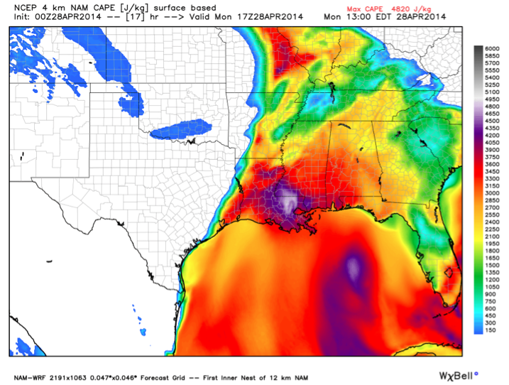
That is pretty unstable air.
Numerous strong storms should form in the unstable airmass over eastern Mississippi before lunchtime and move into western Alabama by early afternoon. As these storms move east and southeast, they will become severe. Some of them will be of the dreaded supercell variety. We have the potential for damaging winds, large hail and tornadoes, even a few strong tornadoes in the moderate risk area. The threat will spread eastward into the slight risk area during the late afternoon and evening hours.
There is some uncertainty concerning the strength of the wind fields, but it appears there will be sufficient shear for not only organized supercells to form, but for tornadoes as well.
Needless to say, this is a developing weather situation. All Alabama residents should review their safety plans in context of where they will be at various times today. Have multiple reliable ways to receive severe weather watches and warnings. And take action when warnings are issued.
Category: Alabama's Weather, Severe Weather
About the Author (Author Profile)
Bill Murray is the President of The Weather Factory. He is the site's official weather historian and a weekend forecaster. He also anchors the site's severe weather coverage. Bill Murray is the proud holder of National Weather Association Digital Seal #0001 @wxhistorianSubscribe
If you enjoyed this article, subscribe to receive more just like it.


