

Sunday Weather Notebook
It is a smorgasbord of weather on this last Sunday and June. We have a lot to talk about, so let’s get to it.
There was major flooding this morning across eastern Arkansas, western Tennessee and northern Mississippi. 7.28 inches of rain fell at Wheatley in St. Francis County, Arkansas. 5.87 inches of rain has fallen at Memphis so far today, which makes it at least the 6th wettest day in their history.

We continue to see signs that the low pressure system off the coat of northeastern Florida and southeastern Georgia will become a tropical depression over the next 48 hours. The system will turn back to the northeast ahead of an approaching trough by midweek. The trough will not only turn the system, it will also allow it to intensify. The GFS now picks up on the system, and the European continue to indicate that the system could become a strong tropical storm or minimal hurricane as it tracks northeastward off the South Carolina coast Thursday and Friday before making landfall in eastern North Carolina.
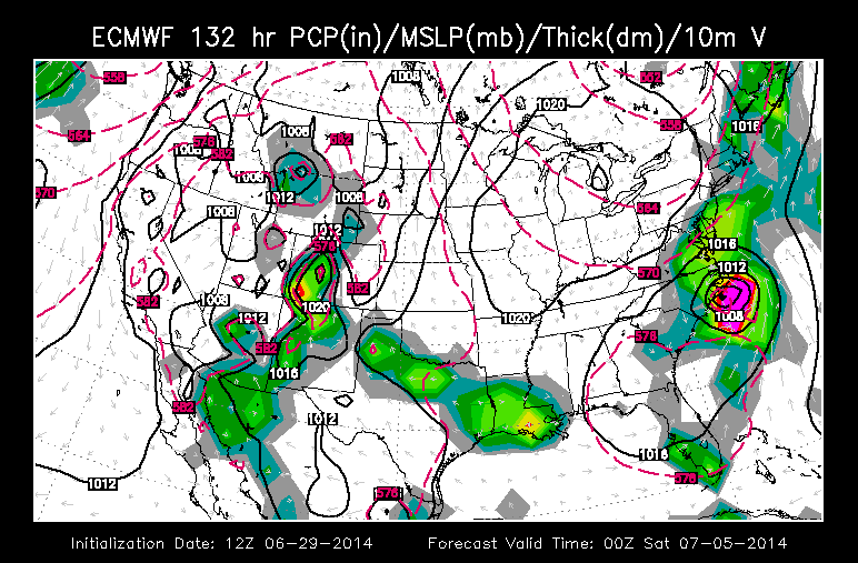
It would then track northeast off the coast as it heads out to see, with no other U.S. landfalls anticipated.
Closer to home, outflow boundaries from last night’s storms triggered storms over East Alabama this afternoon. Those are mainly in Georgia now. Our Tennessee disturbance was triggering a lie of heavy storms from eastern Madison County down into Morgan County. Those storms were approaching 50,000 feet tall!
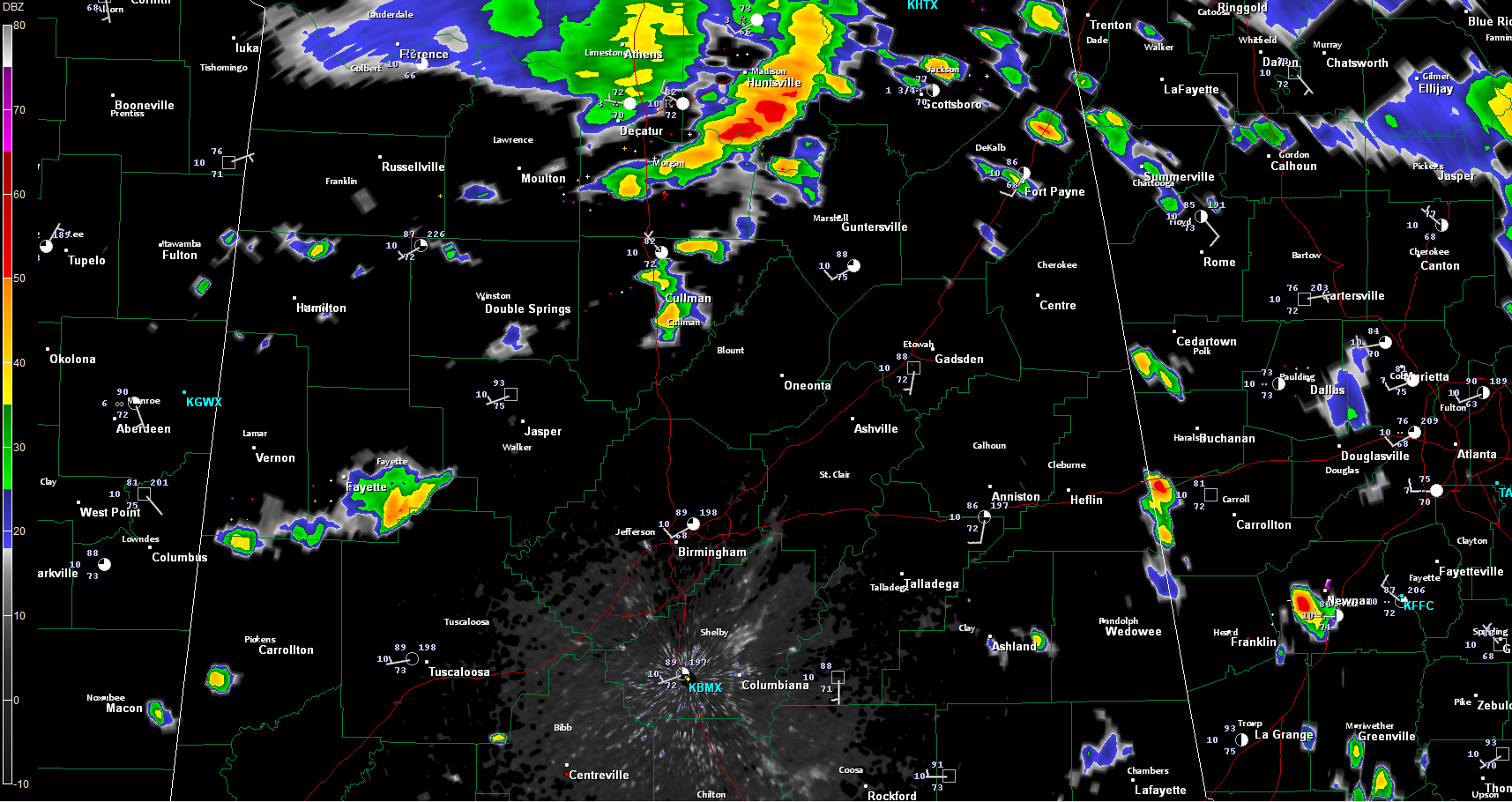
Other storms were scattered from Cullman county down into southern Fayette and northern Tuscaloosa Counties.
The heavier storms will produce very heavy rain, strong gusty winds and intense lightning.
Category: Alabama's Weather, Severe Weather, Tropical
About the Author (Author Profile)
Bill Murray is the President of The Weather Factory. He is the site's official weather historian and a weekend forecaster. He also anchors the site's severe weather coverage. Bill Murray is the proud holder of National Weather Association Digital Seal #0001 @wxhistorianSubscribe
If you enjoyed this article, subscribe to receive more just like it.


