

Mild Weather Continues; A Few Showers
An all new edition of the ABC 33/40 Weather Xtreme video is available in the player on the right sidebar of the blog. You can subscribe to the Weather Xtreme video on iTunes by clicking here.
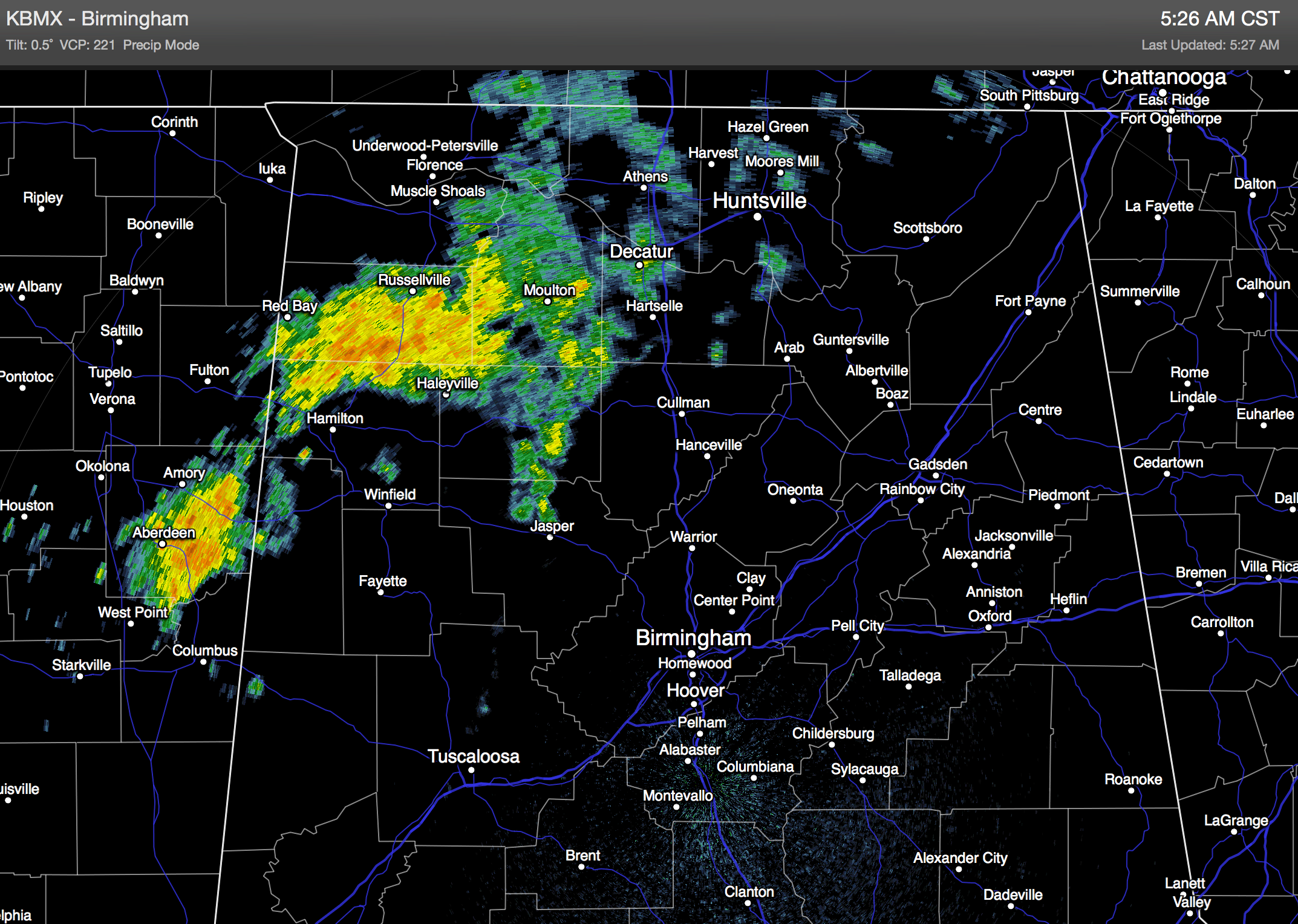
RADAR CHECK: Some rain is falling over North Alabama at daybreak this morning… most of the showers are along and north of U.S. 278 (Hamilton to Cullman to Gadsden). Model data suggests the best chance of rain today will come during the morning hours, and mostly north of I-20. Rain amounts won’t be too heavy.
Otherwise, the day will feature a mix of sun and clouds with a high close to 70 for places like Birmingham, Tuscaloosa, Anniston, and Gadsden. The Tennessee Valley will be cooler with a high in the low to mid 60s.
REST OF THE WEEK: The weather tomorrow and Thursday looks dry and mild; some sun both days with a high near 70, which is about ten degrees above average for early December in Alabama. The 00Z model set suggests the wave at the end of the week on Friday will bring the best chance of showers to the far northern part of the state, and up into Tennessee and Kentucky. If the 12Z data confirms this, we can reduce the chance of rain Friday for areas south of the Tennessee River. And, we stay mild Friday with a high not too far from the 70 degree mark.
THE ALABAMA WEEKEND: No doubt we will need to mention a chance of showers Saturday over the northern half of the state, but rain amounts most likely won’t be too heavy, and it certainly won’t rain all day. Just be aware of the potential for some rain during the day if you have an outdoor event planned. The GFS is printing a high of 67 degrees for Birmingham Saturday, which looks pretty good, and the day will feature more clouds than sun.
Sunday for now looks mostly rain-free as the short wave moves east of Alabama; we will forecast a mix of sun and clouds with a high in the 60s.
ATLANTA WEEKEND WEATHER: For Alabama fans headed to Atlanta for Saturday’s SEC Championship game, needless to say you won’t have to worry about weather issues inside the Georgia Dome… but outside the sky will be mostly cloudy with the chance of a few passing rain showers. Due to cold air damming, the weather will be cooler in Atlanta, and there is a chance they won’t get out of the 50s Saturday.
NEXT WEEK: The GFS hints temperatures get back into a normal range next week; with highs in the 50s and lows in the 30s by mid-week. See the Weather Xtreme video for maps, graphics, and more details.
EARLY GEMINIDS: Earth is entering a stream of debris from “rock comet” 3200 Phaethon, source of the annual Geminid meteor shower. The shower is not expected to peak until Dec. 14th, but NASA meteor cameras are detecting Geminid fireballs over the USA two weeks early. A number of people reported seeing them over Alabama last night.
WEATHER BRAINS: Don’t forget you can listen to our weekly 90 minute netcast anytime on the web, or on iTunes. This is the show all about weather featuring many familiar voices, including our meteorologists here at ABC 33/40. Scroll down for the show notes on the new episode we recorded last night.
CONNECT: You can find me on all of the major social networks…
Facebook
Twitter
Google Plus
Instagram
I will be doing a weather program today at the Waldorf School in Birmingham… look for the next Weather Xtreme video here by 4:00 or so this afternoon. Enjoy the day!
Category: Alabama's Weather
About the Author (Author Profile)
James Spann is one of the most recognized and trusted television meteorologists in the industry. He holds the AMS CCM designation and television seals from the AMS and NWA. He is a past winner of the Broadcast Meteorologist of the Year from both professional organizations.Subscribe
If you enjoyed this article, subscribe to receive more just like it.


