

Severe Thunderstorm Warning for Etowah County

I spoke a little too soon about our storm weakening. It intensified over Etowah County and prompted the NWS to issue a severe thunderstorm warning.
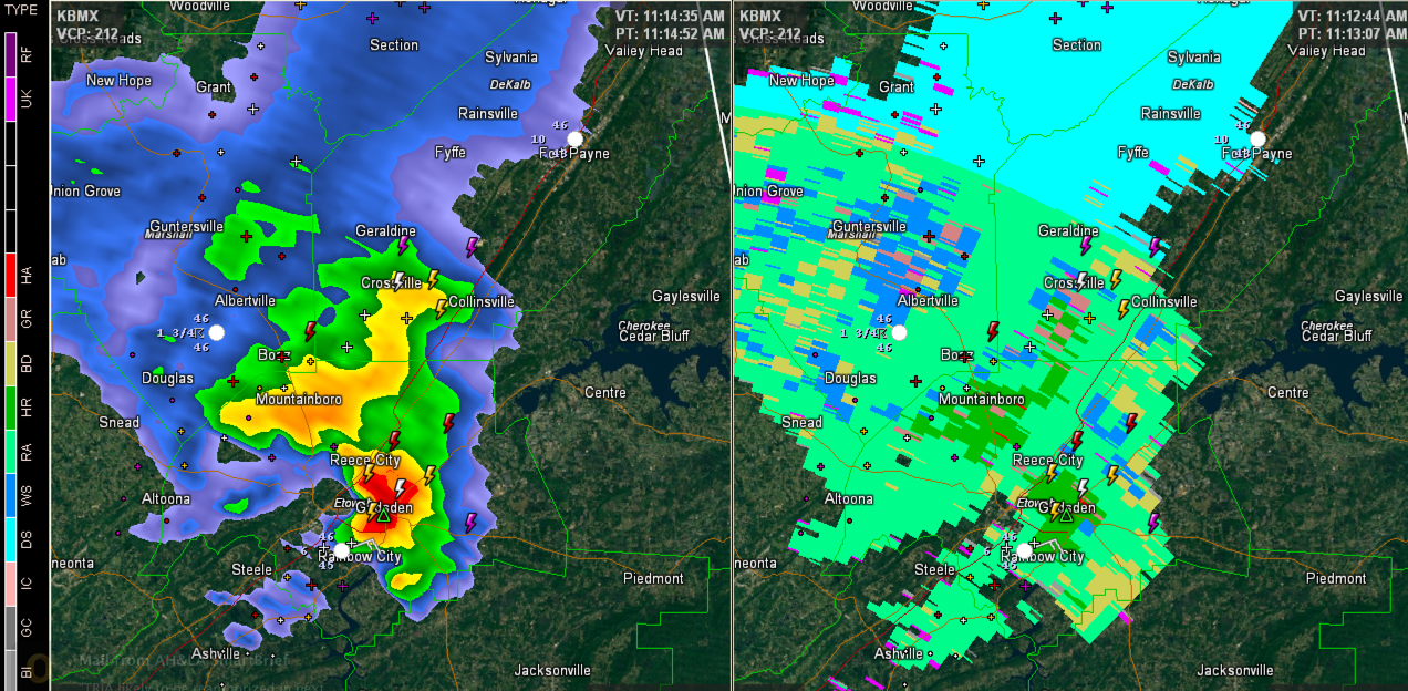
The left side of the image is the base reflectivity you are used to. The right side is the Hydrometeor Classification Algorithm, which shows precip type.
The storm is now over the City of Gadsden. The radar beam from the BMX radar is at about 6300 feet in this image as it intersects the storm.
Hail likely fell in the Rainbow City area.
THE NATIONAL WEATHER SERVICE IN BIRMINGHAM HAS ISSUED A
* SEVERE THUNDERSTORM WARNING FOR…
ETOWAH COUNTY IN NORTHEAST ALABAMA…
* UNTIL NOON CST
* AT 1106 AM CST…THE NATIONAL WEATHER SERVICE INDICATED A SEVERE
THUNDERSTORM CAPABLE OF PRODUCING QUARTER SIZE HAIL…AND DAMAGING
WINDS IN EXCESS OF 60 MPH. THIS STORM WAS LOCATED NEAR RAINBOW
CITY…AND MOVING NORTHEAST AT 50 MPH.
* LOCATIONS IMPACTED INCLUDE…
GADSDEN…HOKES BLUFF…ATTALLA…GADSDEN MALL…GLENCOE…
NOCCALULA FALLS…REECE CITY AND ANDERSON.
THIS INCLUDES…
INTERSTATE 59 EXIT NUMBERS 181 THROUGH 188…
Category: Alabama's Weather
About the Author (Author Profile)
Subscribe
If you enjoyed this article, subscribe to receive more just like it.


