

Severe Thunderstorm Warning for Fayette/Lamar, Pickens Canceled

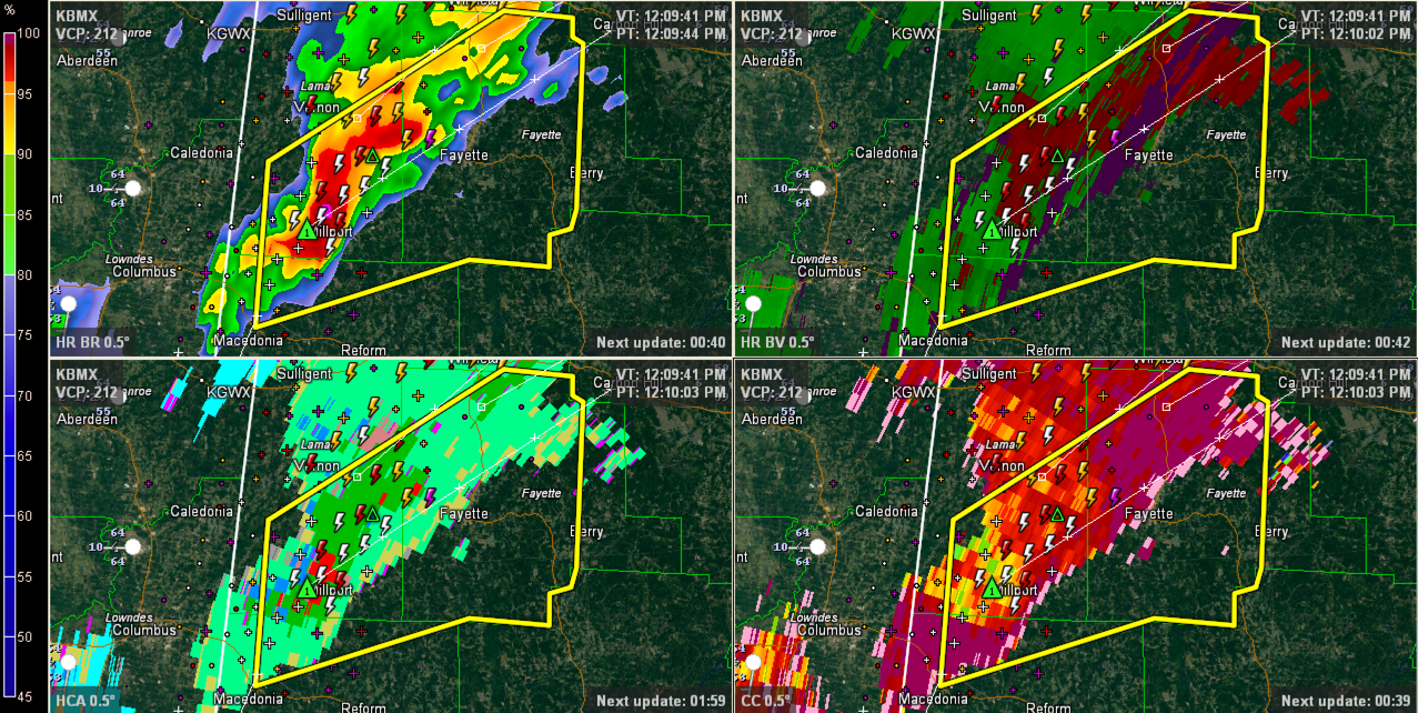
Large hail is falling at Millport most likely. This hail core will move toward Fayette. Hail to the size of quarters is possible. Winds of 60 mph or greater also.
Attention is shifting to the west now where storms will intensify ahead of an approaching cold front. There is an area of slight instability over eastern Mississippi and western and soutwestern Alabama. Storms that form in this area will have the potential to become organized and severe with large hail and damaging winds as we head through the afternoon.
Even stronger storms are extected over southern Louisiana where clearing is occurring allowing for higher instability. These storms will push east and northeast affecting southern Mississippi, southwestern Alabama and the extreme western Florida Panhandle. The SPC has issued an ENHANCED risk area outlook for the area up to Camden, Beatrice and Evergreen. ENHANCED is an upgraded SLIGHT risk forecast. There is a 5-10% chance of tornadoes within 25 miles of points located in the risk area. This area carries a 15-30% wind and a 5-15% hail probability.
THE NATIONAL WEATHER SERVICE IN BIRMINGHAM HAS ISSUED A
* SEVERE THUNDERSTORM WARNING FOR…
FAYETTE COUNTY IN WEST CENTRAL ALABAMA…
SOUTHERN LAMAR COUNTY IN WEST CENTRAL ALABAMA…
NORTHERN PICKENS COUNTY IN WEST CENTRAL ALABAMA…
* UNTIL 100 PM CST
* AT 1206 PM CST…THE NATIONAL WEATHER SERVICE INDICATED A LINE OF
SEVERE THUNDERSTORMS CAPABLE OF PRODUCING QUARTER SIZE HAIL…AND
DAMAGING WINDS IN EXCESS OF 60 MPH. THESE STORMS WERE LOCATED
ALONG A LINE EXTENDING FROM 6 MILES SOUTH OF VERNON TO MILLPORT TO
ETHELSVILLE…AND MOVING NORTHEAST AT 35 MPH.
* LOCATIONS IMPACTED INCLUDE…
MILLPORT…FAYETTE…BLOOMING GROVE…KENNEDY…BELK…BLUFF…
ASHCRAFT CORNER AND BANKSTON.
Category: Alabama's Weather, Severe Weather
About the Author (Author Profile)
Subscribe
If you enjoyed this article, subscribe to receive more just like it.


