Late Morning Notes
I will have a more detailed discussion early this afternoon, but a quick note that the new model runs (12Z) confirm the forecast change. Best chance of freezing rain will be north of the Birmingham metro…
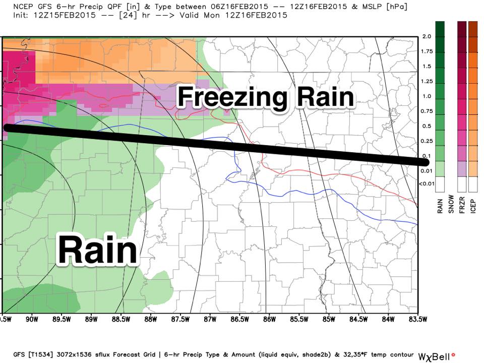
Main threat of freezing rain will be north of a line from Vernon to Warrior to Jacksonville. Most of the Birmingham metro will have a cold rain. Bridge icing is likely where freezing rain falls, with the attendant travel impacts. Highest ice accumulations will come over the Tennessee Valley of far North Alabama.
The hardest part of the forecast continues to be the boundary between freezing rain and rain, and again for now that line seems to be from Vernon to Jacksonville. This could, and probably will change as the event gets underway early tomorrow.
The onset of the precipitation should be in the 3-6 a.m. time frame.
Most of the accumulating snow will be over Tennessee.
A brief change to snow is possible late Monday night, for now the accumulation potential looks small, although some icy patches will be possible where water is standing by early Tuesday morning.
Much more later…
ALABAMA POWER IS READY, ARE YOU? Our friends at Alabama Power are monitoring the forecast closely, ready to deploy people and assets to quickly address any outages that might occur. Read a special message from Ike Piggot about their commitment to their customers.
Category: Alabama's Weather
About the Author (Author Profile)
James Spann is one of the most recognized and trusted television meteorologists in the industry. He holds the AMS CCM designation and television seals from the AMS and NWA. He is a past winner of the Broadcast Meteorologist of the Year from both professional organizations.Subscribe
If you enjoyed this article, subscribe to receive more just like it.


