Sunday Afternoon Update
The 12Z model set confirms our revised forecast from early this morning…
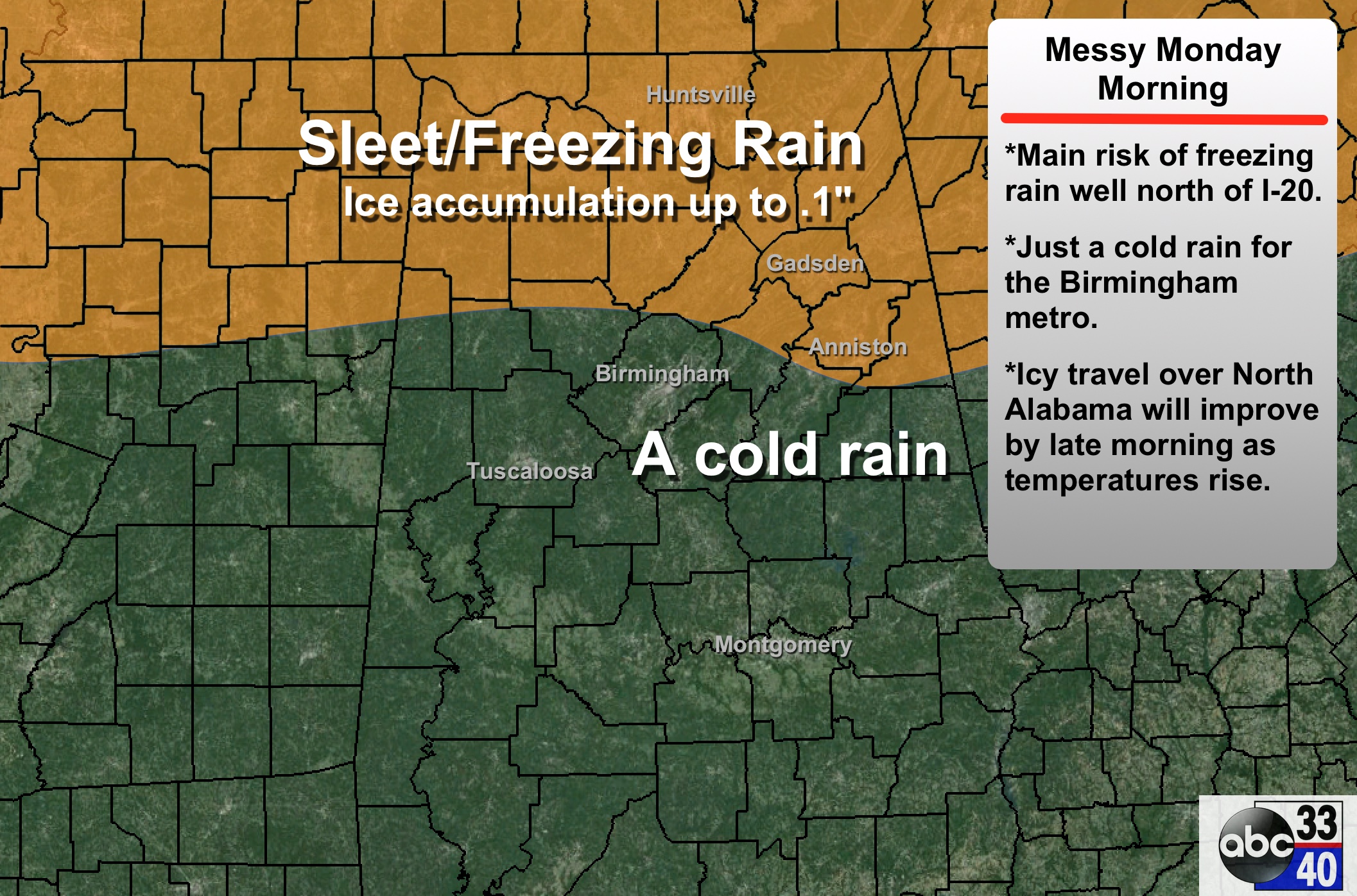
PLACEMENT: The greatest risk of freezing rain and bridge/road icing tomorrow morning will be north of a line from Vernon to Jasper to Oxford. This boundary between a cold rain and freezing rain is the hardest part of the forecast; it could change again as the event begins to unfold late tonight. For now, it looks like just a cold rain for much of the Birmingham metro. There is potential for icy travel around Anniston and Gadsden for a brief time with a colder pocket of low level air expected to be in place over East Alabama.
TIMING: The precipitation will begin sometime between midnight tonight and 6:00 a.m. tomorrow. Freezing rain over North Alabama becomes rain by late morning as temperatures rise.
ACCUMULATION/IMPACT: Ice accumulation around 0.1″ is possible in spots where freezing rain falls; while that won’t bring any widespread power outages, it will bring icy bridges, and maybe even some ice on secondary black top roads. It doesn’t take much freezing rain to create icy travel.
MONDAY NIGHT: Still the chance of a quick changeover to snow on the backside of the departing system Monday night, but it looks like accumulation, if any, will be small. But, where there is standing water some icy spots could develop early Tuesday morning.

WATCHES/WARNINGS: National Weather Service offices in Birmingham and Huntsville will drop the winter storm watch in a few hours, and replace part of it with either a winter weather advisory, or a winter storm warning where the freezing rain is expected to fall. This should be up by 4:00 p.m.
REMEMBER: Expect a few surprises in this kind of event; and please read the 10 things you need to know about winter weather forecasting (which I posted Friday). It helps you to understand what we are dealing with, and how to use these products.
ALABAMA POWER IS READY, ARE YOU? Our friends at Alabama Power are monitoring the forecast closely, ready to deploy people and assets to quickly address any outages that might occur. Read a special message from Ike Piggot about their commitment to their customers.
Stay tuned for updates later this afternoon…
Category: Alabama's Weather
About the Author (Author Profile)
James Spann is one of the most recognized and trusted television meteorologists in the industry. He holds the AMS CCM designation and television seals from the AMS and NWA. He is a past winner of the Broadcast Meteorologist of the Year from both professional organizations.Subscribe
If you enjoyed this article, subscribe to receive more just like it.


