A Very Wet Week Ahead
An all new edition of the ABC 33/40 Weather Xtreme video is available in the player on the right sidebar of the blog. You can subscribe to the Weather Xtreme video on iTunes by clicking here.
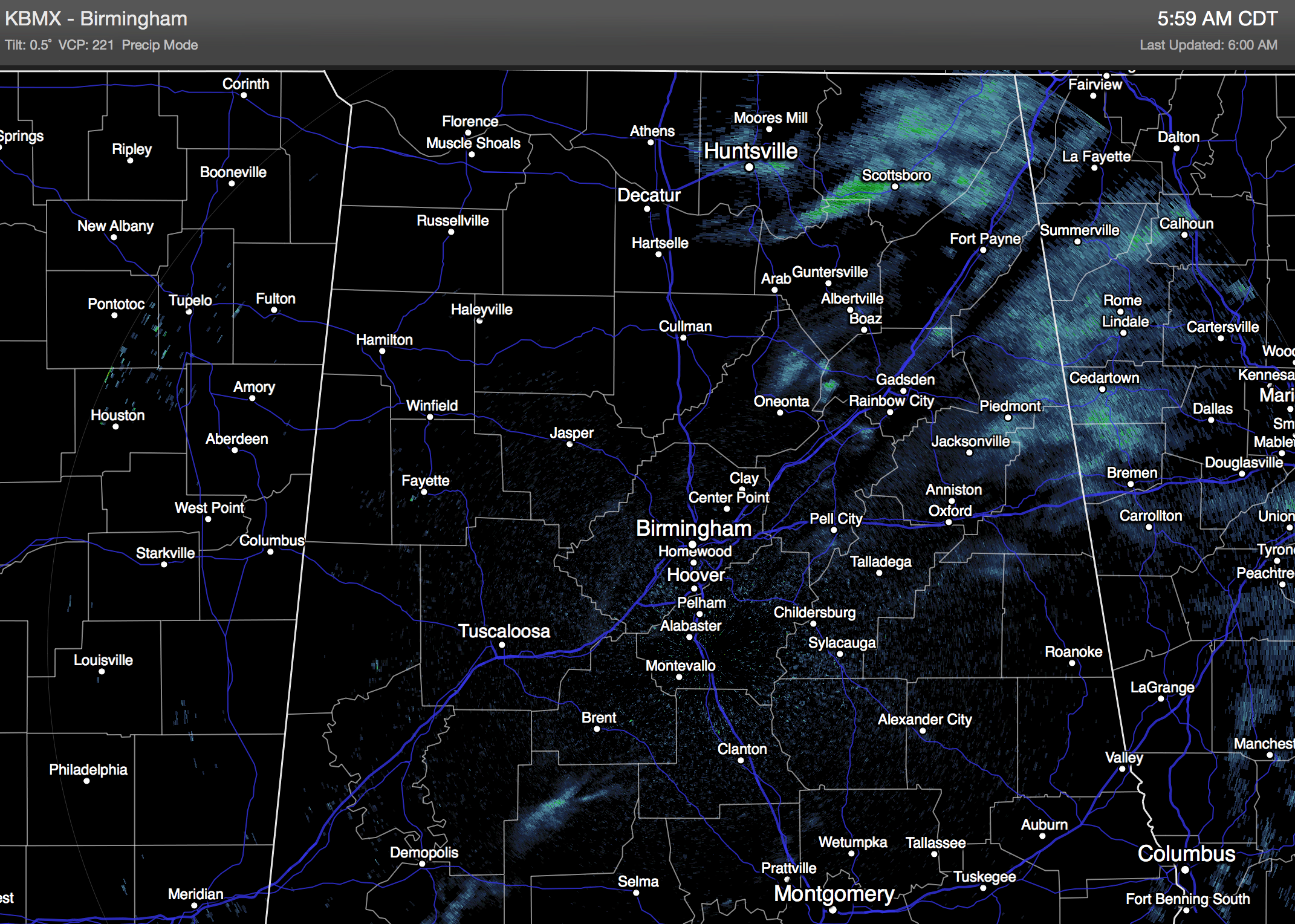
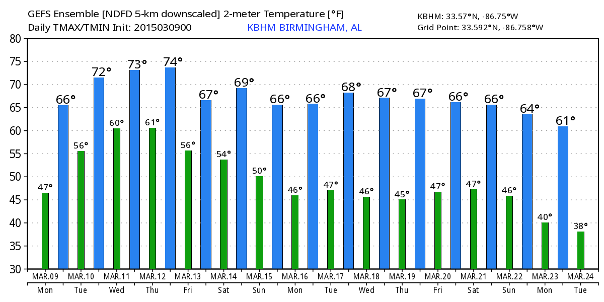
RADAR CHECK: Some very light rain and drizzle is showing on radar this morning; surface dew points are still in the 40s in most places, so the deeper moisture has yet to move up this way from the south. The higher chance of signifiant rain will come this afternoon and tonight as a warm front approaches from the south. The sky will be cloudy and today’s high will be in the mid 60s for most communities.
MID-WEEK: Expect occasional showers and a possibly a few thunderstorms tomorrow and Wednesday as a very moist airmass moves into the state, and an upper trough to the west keeps a disturbed southwest flow aloft in place. It won’t rain every minute of every day, but the rain could come at any time. Highs will be in the low 70s.
Then, on Thursday, a surface low forms over Southeast Louisiana; this will bring yet another wet day for the state with a soaking rain likely. The good news is that the low will be far enough to the south to prevent a severe weather threat, but we will need to monitor for possible flash flooding issues.
FRIDAY: Temperatures will be cooler, with a high closer to 60 degrees, but we will need to maintain a good chance of rain statewide.
THE ALABAMA WEEKEND: While a moist airmass will still be in place, there is no well defined trigger for rain, so showers become more scattered in nature Saturday and Sunday. Still, the sky will be mostly cloudy both days with only a very limited amount of sunshine. Highs over the weekend should be in the 67 to 70 degree range.
Finally, a dry airmass drops into the state early next week, and Monday looks like a mostly sunny day with a high around 70. See the Weather Xtreme video for maps, graphics, and more details.
WEATHER BRAINS: Don’t forget you can listen to our weekly 90 minute netcast anytime on the web, or on iTunes. This is the show all about weather featuring many familiar voices, including our meteorologists here at ABC 33/40. We will produce this week’s show tonight at 8:30 CDT… you can watch it on “James Spann 24/7” on cable systems around the state, or on the web here…
CONNECT: You can find me on all of the major social networks…
Facebook
Twitter
Google Plus
Instagram
I have a weather program this morning at Isabella School in Chilton County… be looking for the next Weather Xtreme video here by 4:00 this afternoon. Enjoy the day!
Category: Alabama's Weather
About the Author (Author Profile)
James Spann is one of the most recognized and trusted television meteorologists in the industry. He holds the AMS CCM designation and television seals from the AMS and NWA. He is a past winner of the Broadcast Meteorologist of the Year from both professional organizations.Subscribe
If you enjoyed this article, subscribe to receive more just like it.


