Will Mississippi Severe Storms Make It Into Alabama?
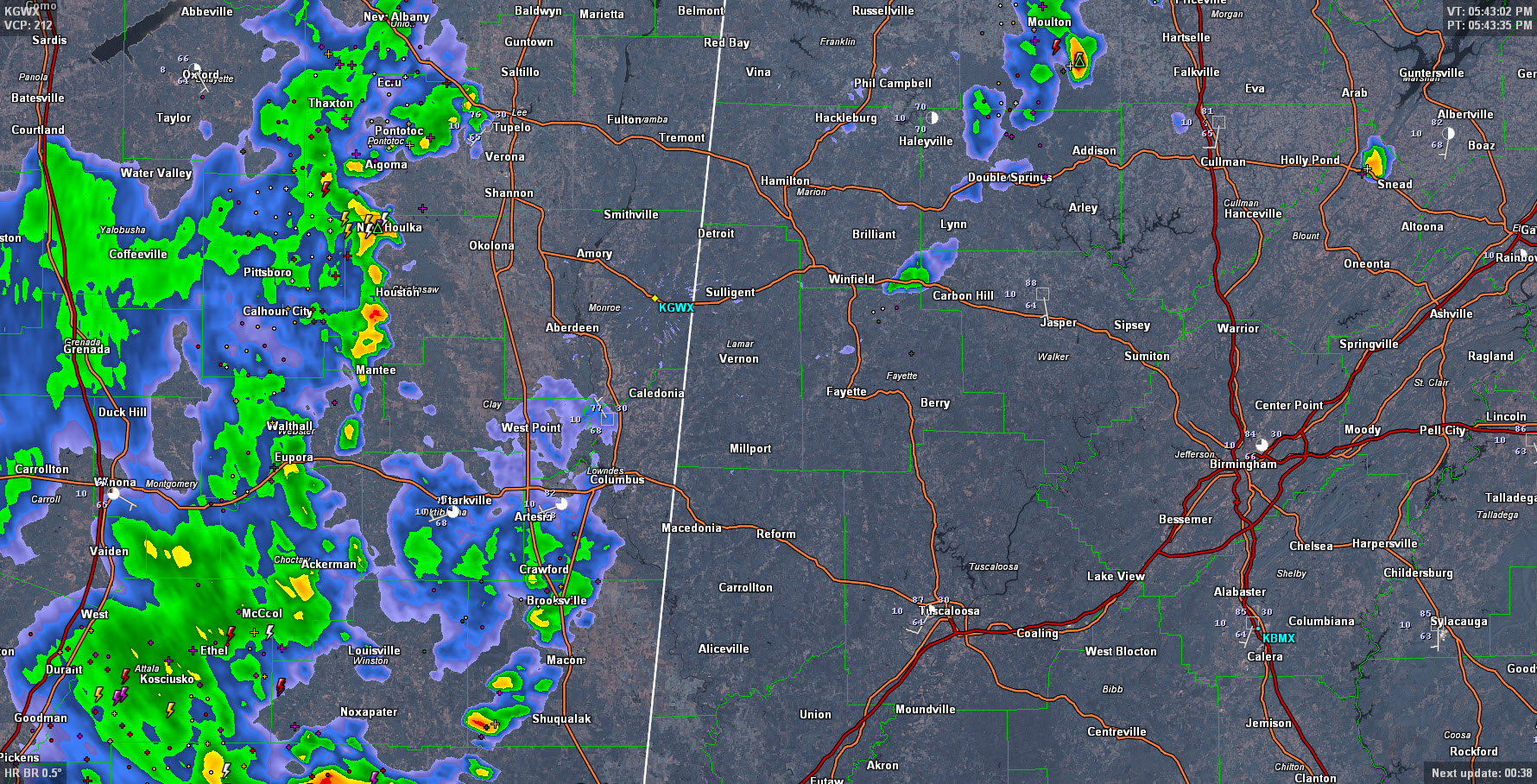
Thunderstorms intensified this afternoon near I-55 in Mississippi and have been pushing eastward.
They are being maintained by a pool of cold air over southern Mississippi that enhances instability. There have been a couple of severe thunderstorm warnings in Mississippi around Starkville and Carthage.
The storms that are west of Columbus MS may hold together enough to eventually get into Northwest Alabama around Marion County, but wind shear is very light and instability ahead of the system is less, so the chance of severe severe weather lessens as they approach the Alabama border. You can already see some overall weakening of the activity.
An outflow boundary over Northwest Alabama from Lamar through northwestern Fayette, across northwestern Walker and into Winston Counties may provide enough focus for additional showers/storms to pop up over the next couple of hours. One such storm just bubbled up briefly near Eldridge along the Marion/Walker County line. The boundary will meander a little further southeast and peter out.
So far, the forecast that most of the activity would stay north and west of I-59 has held. The evening should be quiet across the state. Storms should be more widespread tomorrow and we will likely deal with some severe weather.
Category: Severe Weather
About the Author (Author Profile)
Bill Murray is the President of The Weather Factory. He is the site's official weather historian and a weekend forecaster. He also anchors the site's severe weather coverage. Bill Murray is the proud holder of National Weather Association Digital Seal #0001 @wxhistorianSubscribe
If you enjoyed this article, subscribe to receive more just like it.


