

Storms Into Birmingham in About an Hour
Storms over Central Alabama are now making a beeline for the Birmingham area.
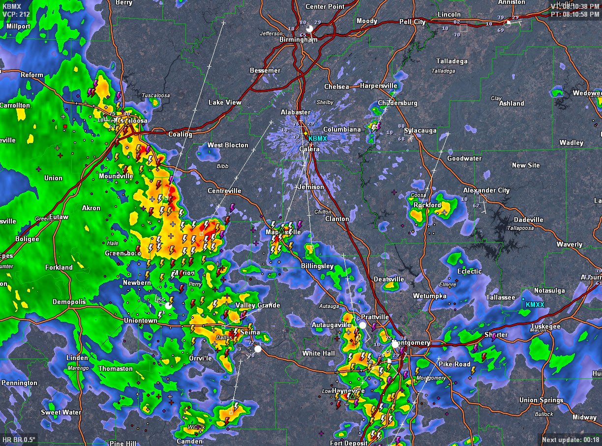
It is storming loudly in Tuscaloosa right now with lows of lightning, torrential rains and gusty winds. Winds gusted to 29 mph at the Tuscaloosa Airport as the storms approached. The storms extend southeastward through eastern Hale and western Bibb County to near Marion in Perry County to west of Selma. Selma will be getting lots of lightning, wind and rain shortly. Storms are strong in the Maplesville area of Chilton County. They are now approaching the Montgomery area from the southwest as well.
The storms will make into Birmingham within the next 90 minutes, reaching southwestern Jefferson and Shelby Counties around 9 p.m. and into the rest of the Metro between 9-10 p.m.
The storms should not become severe but expect torrential rains, lots of lightning and gusty winds. Rainfall amounts should average one half inch with some isolated amounts to one inch. There have been some brief one hour totals near 1.5 inches around Uniontown on US-80 between Demopolis and Selma.
Category: Alabama's Weather
About the Author (Author Profile)
Bill Murray is the President of The Weather Factory. He is the site's official weather historian and a weekend forecaster. He also anchors the site's severe weather coverage. Bill Murray is the proud holder of National Weather Association Digital Seal #0001 @wxhistorianSubscribe
If you enjoyed this article, subscribe to receive more just like it.


