A Hot Sunday
As we get ready to cross the noon hour on this mid-July Sunday, it’s hot. Temperatures are climbing into the lower 90s now with heat index values climbing over 100F.
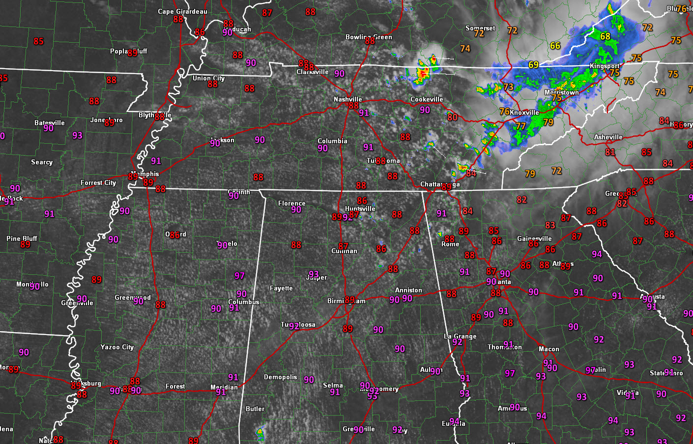
A nice cumulus field was developing, especially along and north of I-59.
To the northeast, thunderstorms were sliding southeastward across eastern Kentucky and eastern Tennessee, associated with a mesoscale convective complex. The fringes of this system will help to trigger a few isolated showers and storms over Northeast Alabama. A few were beginning to show up on radar over Madsion, Jackson, Cherokee and Etowah Counties.
With all the heat and moisture out there, there is lots of energy in the atmosphere, but warm mid-level temperatures have a nice lid on things, and storms will have a hard time getting going. There will be widely spaced small storms today, but the chance you will see one at less than one in five.
Heat advisories are in effect for western and southern sections of the area, including Autauga, Barbour, Bibb, Bullock, Dallas, Fayette, Greene, Hale, Lamar, Lowndes, Marengo, Marion, Montgomery, Perry, Pickens, Pike, Sumter, Tuscaloosa, Walker and Winston Counties.
Take it easy if you will be working or playing outside this afternoon. Take breaks and stay hydrated.
Category: Alabama's Weather
About the Author (Author Profile)
Bill Murray is the President of The Weather Factory. He is the site's official weather historian and a weekend forecaster. He also anchors the site's severe weather coverage. Bill Murray is the proud holder of National Weather Association Digital Seal #0001 @wxhistorianSubscribe
If you enjoyed this article, subscribe to receive more just like it.


