A Few Overnight Showers Possible
THIS AFTERNOON: We do have some breaks in the overcast this afternoon across the great state of Alabama…
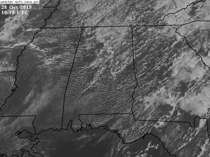
There are a few isolated showers over the northern half of the state, but most places are dry with temperatures in the low to mid 70s.
TONIGHT: A cold front will pass through early tomorrow, and will bring the threat of showers, and possibly a thunderstorm overnight. Main window for this will come from about 12:00 midnight until 8:00 a.m…. rain amounts should be under 1/2 inch, and the best coverage of showers should be over the northern third of the state.
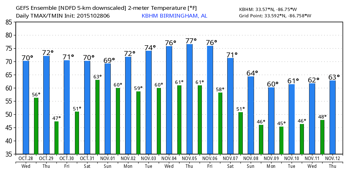
TOMORROW/FRIDAY: Showers should end by mid-moring tomorrow, and the sky becomes partly to mostly sunny by afternoon. The high will be in the mid 70s. Then, Friday promises to be a delightful day with sunshine in full supply, low humidity, and a high around 70 after starting the day in the 40s. Looks like a great night for high school football.
RAIN RETURNS FOR THE WEEKEND: The next weather system to the west will spread clouds back into the state Saturday, and rain and thunderstorms are likely Saturday night and Sunday. The rain should reach West Alabama in the 3:00-5:00 p.m. time frame, the I-65 corridor around 6:00 p.m.. and East Alabama after 7:00 p.m. Best chance of a dry trick or treat run through the neighborhood will be over the eastern counties of the state early in the evening.
The latest model set (12Z) shows a weaker surface low farther south, so the severe weather threat Sunday looks low for now. But, it will be a good rain event with about 2 inches a decent possibility for most of the state.
NEXT WEEK: Showers end early Monday, and the weather looks dry and mild Monday afternoon through Thursday, with highs well up in the 70s thanks to an upper ridge overhead. The western U.S. will be cold and unsettled, however, and many places will experience their first good snow of the season next week. See the Weather Xtreme video for maps, graphics, and more details.
FOOTBALL WEATHER: For Saturday’s Magic City Classic in Birmingham… the sky will be mostly cloudy when Alabama State and Alabama A&M kickoff at Legion Field (2:30p CT), temperatures will fall from the mid 70s at kickoff into the low 70s by the fourth quarter. I can’t rule out some rain reaching the stadium late in the game; it should be wet on your way back to the parking lot. Widespread rain is likely in Birmingham Saturday night.
Auburn hosts Ole Miss Saturday at Jordan-Hare Stadium at 11:00; at this point the weather looks mostly cloudy, but the chance of rain holds off until Saturday night, well after the game is finished. Temperatures will rise from the upper 60s at kickoff into the low to mid 70s by the fourth quarter.
Alabama takes the weekend off.
AT THE BEACH: Mostly sunny weather is the story tomorrow and Friday with highs in the 70s. Rain returns Sunday… See the complete Gulf Coast 7 Day Planner here. The Gulf Coast Beach Forecast is presented by Gulf Shores Plantation by Mandoki Hospitality Vacation Rentals. Escape to Gulf Shores Plantation where memories last a lifetime.
WEATHER BRAINS: Don’t forget you can listen to our weekly 90 minute netcast anytime on the web, or on iTunes. This is the show all about weather featuring many familiar voices, including our meteorologists here at ABC 33/40.
CONNECT: You can find me on all of the major social networks…
Facebook
Twitter
Google Plus
Instagram
Look for the next Weather Xtreme video here by 7:00 a.m. tomorrow…
Category: Alabama's Weather
About the Author (Author Profile)
James Spann is one of the most recognized and trusted television meteorologists in the industry. He holds the AMS CCM designation and television seals from the AMS and NWA. He is a past winner of the Broadcast Meteorologist of the Year from both professional organizations.Subscribe
If you enjoyed this article, subscribe to receive more just like it.


