

Quick Radar Update at 9:15 p.m.
Click image to enlarge.
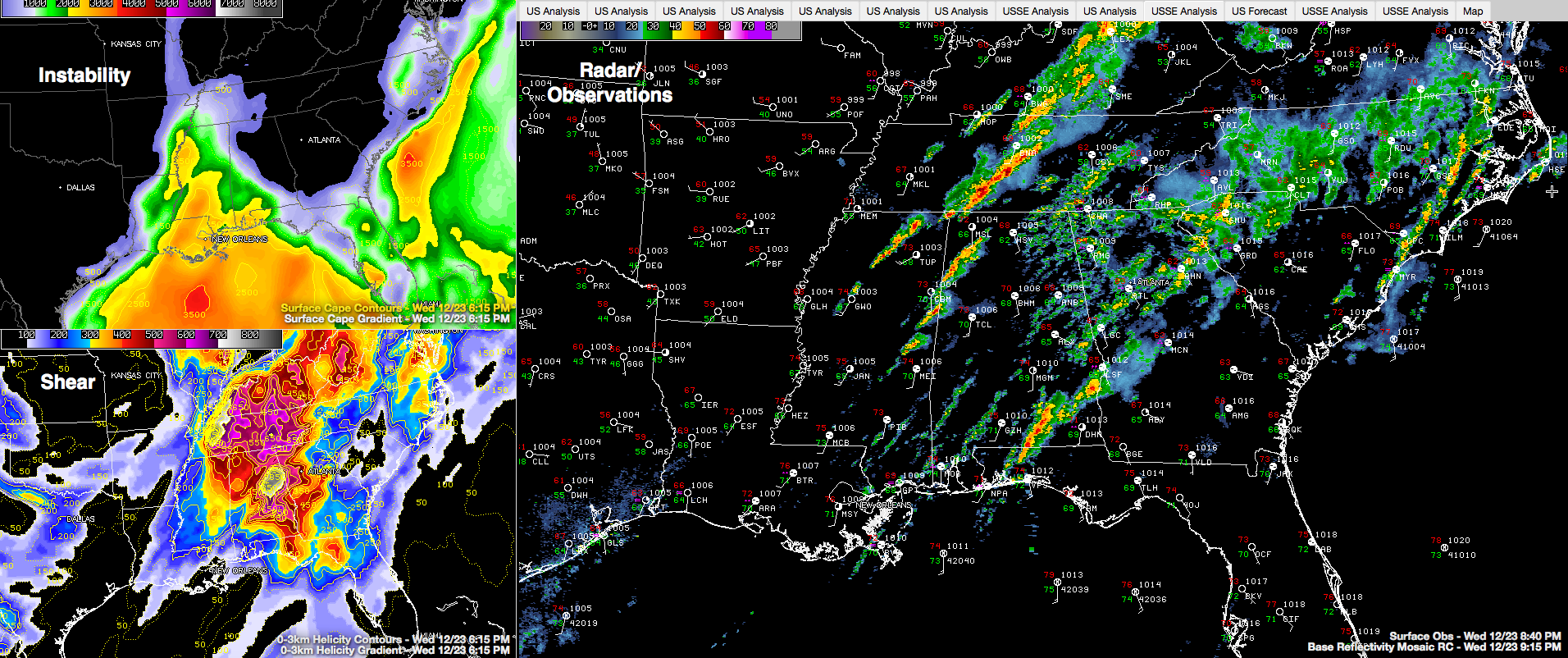
Thunderstorms continue over Northwest Alabama at this hour. They extend across Lamar, Marion and into southeastern Franklin County, from near Sulligent to Hamilton to Phil Campbell. These storms will also move into Fayette County.
Other storms south of Columbus MS will push across parts of Pickens County shortly. Storms near Macon MS will move into Sumter and Greene Counties within the hour.
The storms are not severe, but could become so at any time with strong wind shear in place. They are producing heavy rain and lightning along with some gusty winds.
They formed in an instability and moisture axis over Mississippi. This axis is slowly tracking eastward with a slow moving trough of low pressure. A slow moving cold front is approaching the Mississippi River.
The dewpoint at Birmingham has reached 68F, quite unusual for Central Alabama in late December.
A second line of storms extends from east of the Nashville area to the Northwest Corner of Alabama and back into northern Mississippi.
Elsewhere, showers cover much of the eastern half of the state.
There are indications the two lines will eventually merge, pushing across Northwest Alabama overnight and reaching I-59 around 3 a.m. and the Anniston area around 5 a.m.
A tornado watch remains in effect for much of the Northwestern third of Alabama including the western half of Central half of Alabama.
Category: Alabama's Weather, Severe Weather
About the Author (Author Profile)
Bill Murray is the President of The Weather Factory. He is the site's official weather historian and a weekend forecaster. He also anchors the site's severe weather coverage. Bill Murray is the proud holder of National Weather Association Digital Seal #0001 @wxhistorianSubscribe
If you enjoyed this article, subscribe to receive more just like it.


