

Checking in Just After 2:30 a.m.
As we thought it might, the main line of showers and thunderstorms has slowed its forward progress this morning. Shortly before 2:30 a.m., the line extended from Albertville to Oneonta to Pinson to the City of Tuscaloosa to near Emelle in Sumter County. That is not much progress from last time we described its position.
A second line is over southeast Alabama.
Additional showers and storms gave formed and will continue to grow in coverage and intensity it appears overnight. Instability values have held in the 2,000+ j/kg category.
Infrared satellite imagery has show an increase in the intensity of the storms in the line as an upper level disturbance approaches from the west.
A tornado watch continues until 4 a.m. for areas ahead of the line of storms. 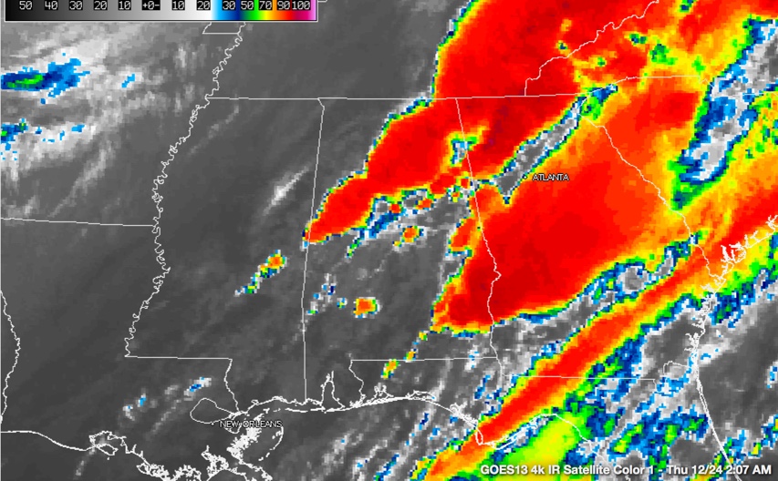 But the storms have not become severe so far.
As the storms grow in coverage, the stalling of the line will present the potential for flooding as the cells train over the same area.
Category: Alabama's Weather, Severe Weather
About the Author (Author Profile)
Bill Murray is the President of The Weather Factory. He is the site's official weather historian and a weekend forecaster. He also anchors the site's severe weather coverage. Bill Murray is the proud holder of National Weather Association Digital Seal #0001 @wxhistorianSubscribe
If you enjoyed this article, subscribe to receive more just like it.


