

Tuscaloosa County Storms Have Strengthened
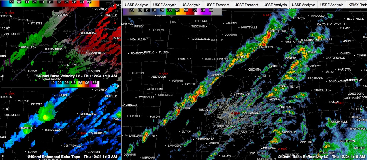
Storms have intensified over Tuscaloosa County and over eastern Pickens Counties early this morning. They are not severe, but they are some of the strongest storms we have seen across Central Alabama during this event. The tops of the thunderstorms are over 40,000 feet, and the storm north of the cities of Tuscaloosa and Northport is approaching 50,000 feet tall.
The northern Tuscaloosa County storm is producing lots of lightning and has taken on a signature that could indicate a higher potential for damaging winds. This storm will move across rural northeastern Tuscaloosa County and eventually western Jefferson County.
Interestingly, instabilities have increased in a zone just east of I-65 from Birmingham to Montgomery. There is still sufficient wind shear for rotating updrafts in these taller storms.
Further north, the storm northeast of Hanceville has also grown to a height of nearly 50,000 feet as well.
Be ready for strong wind gusts, some hail and even an isolated tornado as these storms approach.
Category: Alabama's Weather, Severe Weather
About the Author (Author Profile)
Bill Murray is the President of The Weather Factory. He is the site's official weather historian and a weekend forecaster. He also anchors the site's severe weather coverage. Bill Murray is the proud holder of National Weather Association Digital Seal #0001 @wxhistorianSubscribe
If you enjoyed this article, subscribe to receive more just like it.


