

Strong Storms Over Walker County
Still no severe weather across Central Alabama this evening as we pass the witching hour. A severe thunderstorm warning was just issued for Coffee County in Southeast Alabama.
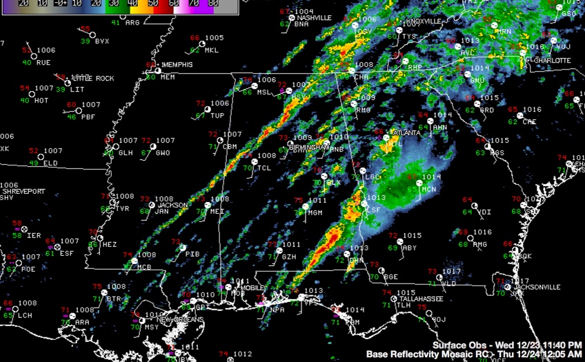
A narrow but nearly solid line of showers and thunderstorms extends from Arab to Hanceville to Jasper to east of Berry then on to Aliceville.
The strongest storm is in the Jasper area in Walker County. It will impact the Cullman area.
The storms are not severe but they do have lightning. A strong low level jet has led to some gusty winds but the storms have not had the steep temperature decreases with height that you would need to see for bringing really strong winds to the surface.
The strongest low level helicity is exiting to the northeast, but there is still sufficient shear to create organized storms. Although the instability over the area is decreasing, it is still rather impressive for midnight in late December.
Fayette and Winston Counties have been cleared from the tornado watch. These counties are still in the watch: Bibb, Greene, Hale, Jefferson, Pickens, Shelby, Sumter, Tuscaloosa and Walker till 4:00 AM CST,
Category: Alabama's Weather, Severe Weather
About the Author (Author Profile)
Bill Murray is the President of The Weather Factory. He is the site's official weather historian and a weekend forecaster. He also anchors the site's severe weather coverage. Bill Murray is the proud holder of National Weather Association Digital Seal #0001 @wxhistorianSubscribe
If you enjoyed this article, subscribe to receive more just like it.


