

Satellite View
Here’s a look at the visible satellite image for late this Saturday morning.
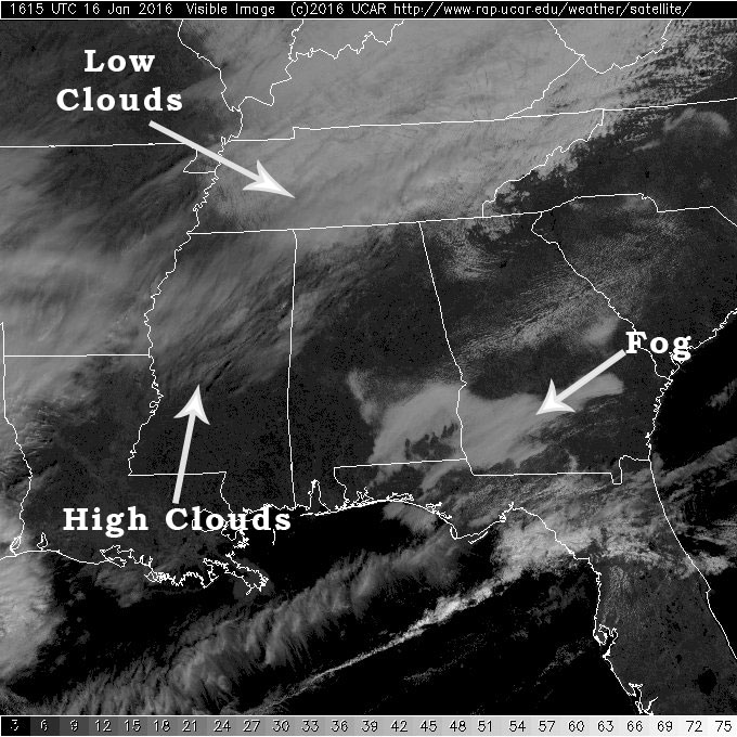
Much of Alabama is experiencing some welcome sunshine, but not all areas. As I’ve noted in the image, fog was still in place in the southeast portion of Alabama and southwest corner of Georgia. Looks like that fog is fairly thick so it probably will not burn off completely until noon or a little after.
High clouds over Central Mississippi will sweep into parts of North and Central Alabama for the late morning. I suspect much of Alabama will see some high clouds later this afternoon.
And those low clouds over Middle Tennessee were slowing moving southeastward, so the extreme northern sections of the Tennessee River Valley will see mostly cloudy skies for the rest of the morning and the afternoon.
Interesting to note the very dry layer between 900 and 400 millibars this morning on the upper air sounding taken at the Shelby County Airport.

Still watching developments well to our west. Kevin Selle in Wichita Falls, our good friend and fellow WeatherBrain, is dealing with a light snow situation as temperatures there tumble toward the freezing mark. It appears that the snow there will not be enough to create any major impact for travel.
-Brian-
Category: Alabama's Weather
About the Author (Author Profile)
Brian Peters is one of the television meteorologists at ABC3340 in Birmingham and a retired NWS Warning Coordination Meteorologist. He handles the weekend Weather Xtreme Videos and forecast discussion and is the Webmaster for the popular WeatherBrains podcast.Subscribe
If you enjoyed this article, subscribe to receive more just like it.


