A Bi-Hourly Look At How Tonight’s Event May Unfold
Here is a bi-hourly view of how tonight’s event will unfold using the High Resolution Rapid Refresh model.
7PM
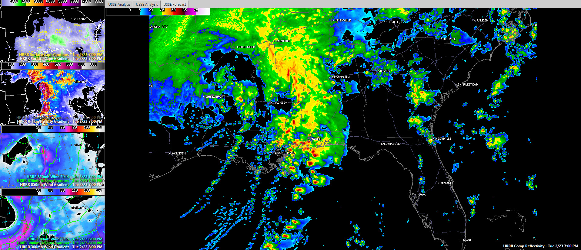
Intense storms now crossing I-59 in southern Mississippi will be into Southwest Alabama. They will intensify as they move into more unstable air over Southwest Alabama. Low level helicity will be very high, maintaining the threat of tornadoes. The low level jet will be moving into West Central Alabama at that time too. Heavy rain and storms will cover much ofteh western third of Alabama by then.
9 PM

As we get to the 9 o’clock hour, storms approaching West Central Alabama from Mississippi look more cellular according to the composite reflectivity off the HRRR model. That is not good news, as it indicates a higher tornado potential. Helicity will definitely be maximized across that area with values over 400 m2/s2. The low level jet will be directly overhead with highs of 60-70 knots. The nose of a jet stream wind maximum will also be edging into the area causing diffluence aloft, which will help cause left as well. Thunderstorms will be widespread from The Florida Panhandle up into Sumter and Greene Counties. BY 10 p.m. these storms could be into Tuscaloosa. Heavy storms will also be across North Central and North Alabama at that time.
11 PM
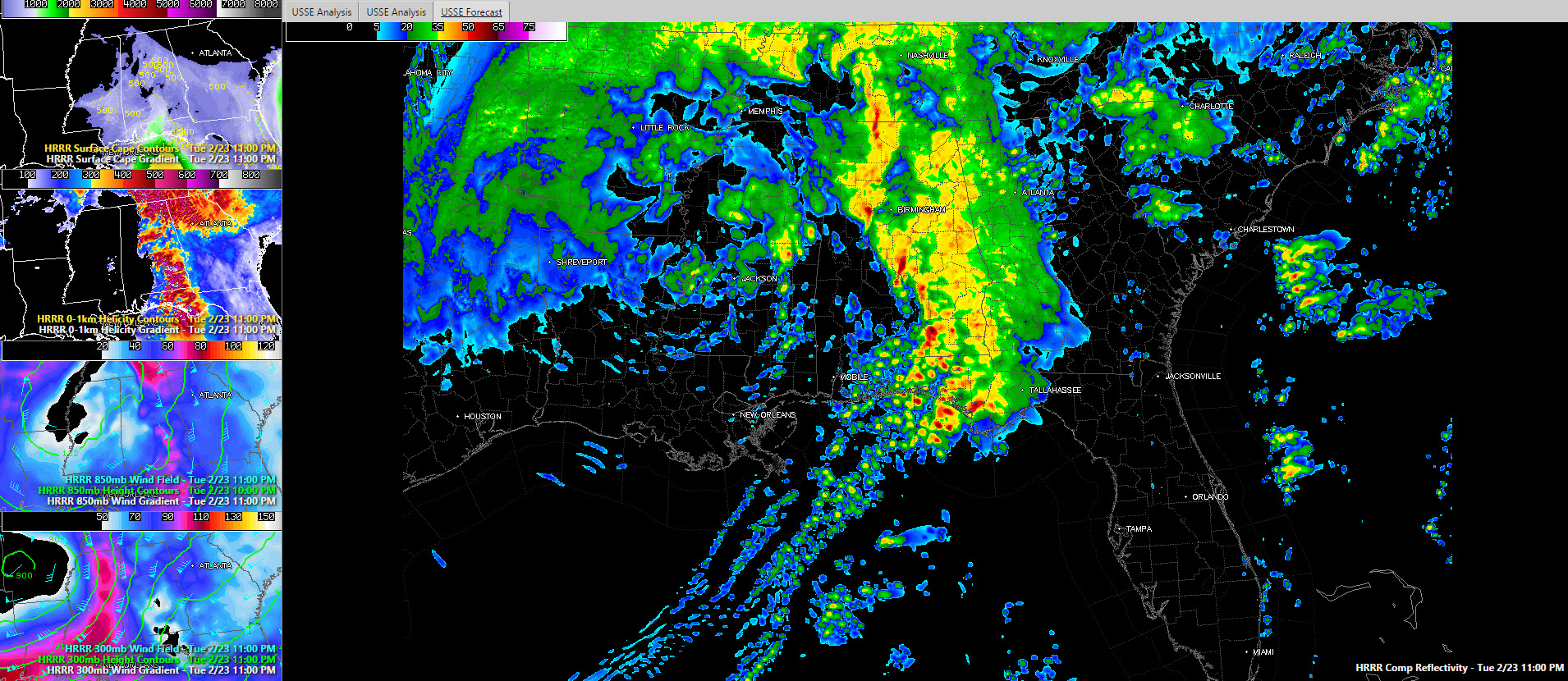
The heaviest weather should be in a line from Hamilton, Walker and fayette Counties down through Bibb, Chilton and Autauga Counties and on into South Alabama. Severe storms could be approaching Birmingham at that time. Instability will be waning, but the helicity will still be off the chart, and the low level jet will be intensifying as the surface low passes north of Jackson MS. The jetmax will be entering WEst Alabama by then too with winds of over 110 knots at 30,000 feet.
1 AM
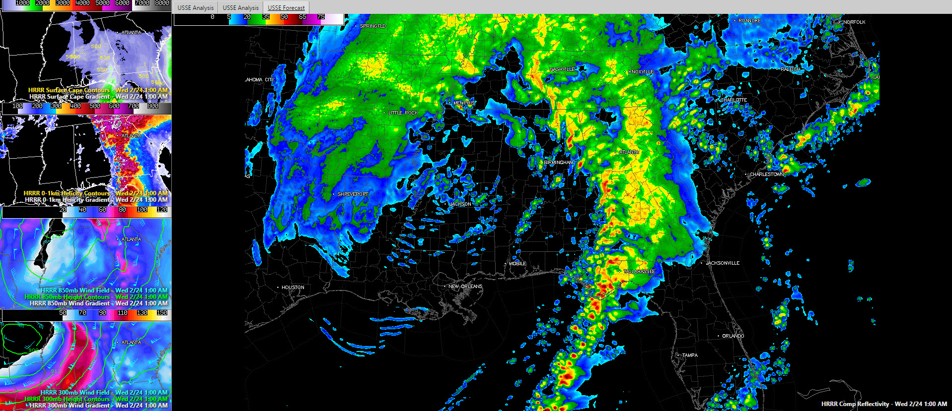
The storms will be weakening north of I-20, but there could still be spin up tornadoes with the intense helicity before it departs into Georgia. Shortly after that, the activity should push into Georgia and perhaps we can get some sleep!
A new tornado watch will be needed soon for parts of Central Alabama.
Category: Alabama's Weather, Severe Weather
About the Author (Author Profile)
Bill Murray is the President of The Weather Factory. He is the site's official weather historian and a weekend forecaster. He also anchors the site's severe weather coverage. Bill Murray is the proud holder of National Weather Association Digital Seal #0001 @wxhistorianSubscribe
If you enjoyed this article, subscribe to receive more just like it.


