Strong Storms Over Northwest/West Central Alabama
Showers and thunderstorms are firing along and north of an outflow boundary that extends from Central Mississippi back into Northwest Alabama this afternoon.
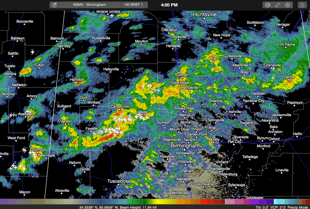
The leading edge extends from Holly Pond and Arley to Fayette and Berry into Mississippi south of Starkville and on to Kosciusko. Storms in NE Mississippi are quite strong near Tupelo, Aberdeen and Pittsboro.
In Alabama the strongest storms were across southern fayette County, near Fayette and Berry. A strong storm was approaching Hamilton.
Quite a bit of lightning across Marion, Winston, Walker and Fayette Counties.
These are decent sized storms, with tops over 30,000 feet.
While low level lapse rates are not conducive for intense stors, mid level lapse rates continue to steepen, which can lead to more robust thunderstorm updrafts.
None of the storms are severe at this time, but we continue to monitor instabilities that are over 500 joules/kg over part of West Central Alabama, in an area bounded by Fayette, Birmingham and Selma. Storms in this area could get really going, will remain organized with good wind shear and could produce damaging winds and large hail. The tornado threat is very small.
Be inside as storms approach your area and pay attention to a reliable source of weather warnings in case one is issued for your area.
Still no further word on the possibility of a severe thunderstorm watch. We will be watching.
Category: Alabama's Weather, Severe Weather
About the Author (Author Profile)
Bill Murray is the President of The Weather Factory. He is the site's official weather historian and a weekend forecaster. He also anchors the site's severe weather coverage. Bill Murray is the proud holder of National Weather Association Digital Seal #0001 @wxhistorianSubscribe
If you enjoyed this article, subscribe to receive more just like it.


