Storms Intensifying West/Northwest of Tuscaloosa/Birmingham
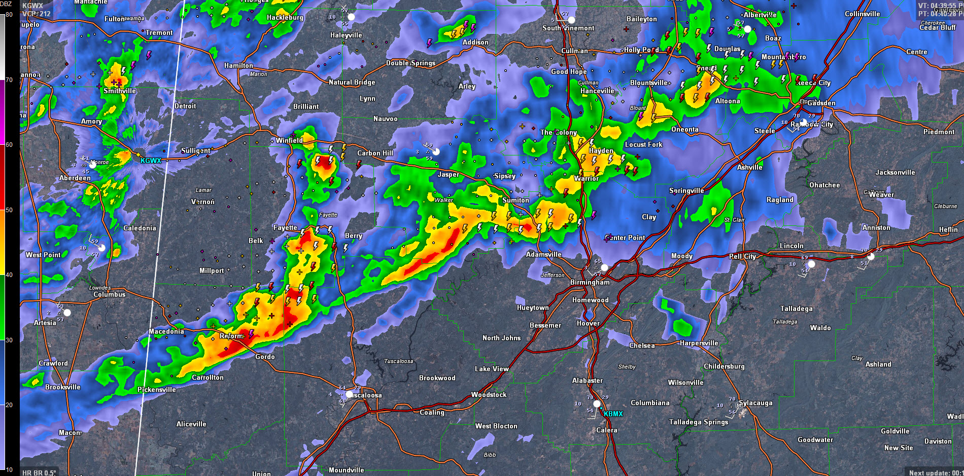
Strong storms across northern Pickens and southern Fayette Counties extend over across southern Walker and into northern Jefferson and southwestern Blount Counties at this hour.
Still nothing severe, although the threat for damaging winds is ramping up slowly.
The strongest storms extend from Winfield to Fayette to Reform. They are moving east and will graze the Tuscaloosa/Northport area in 20-35 minutes, passing just north of those cities.
They will enter the Birmingham Metro around 540 p.m. and will cross the Metro between then and 630.
Areas from Adamsville to Gardendale/Fultondale over to Center Point, Tarrant, Trussville, Clay and Argo will see strong storms between 515-545 p.m.
Lots of lightning and heavy rain with these storms as well as the threat of wind gusts to near 50 mph.
Category: Alabama's Weather, Severe Weather
About the Author (Author Profile)
Bill Murray is the President of The Weather Factory. He is the site's official weather historian and a weekend forecaster. He also anchors the site's severe weather coverage. Bill Murray is the proud holder of National Weather Association Digital Seal #0001 @wxhistorianSubscribe
If you enjoyed this article, subscribe to receive more just like it.


