

Scattered Afternoon Thunderstorms
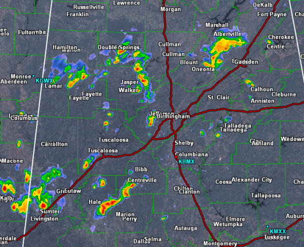
Storms developed over western portions of Alabama early this afternoon. These storms have been moving to the east-southeast and have made their way into central portions of the state.
Thunderstorms are currently affecting portions of Fayette, Walker, Winston, Blount and Etowah Counties.
There is a strong thunderstorm in western portions of Jefferson County impacting areas around Hueytown, Pleasant Grove and Fairfield. This particular cell should end up affecting areas around Homewood and Hoover around 4PM.
There are also additional showers and storms impacting Bibb, Perry, Hale and Sumter Counties.
Today’s convection is producing very heavy rainfall, tremendous amounts of lightning and very loud thunder. Storms will persist for the next several hours and additional development is expected across Central Alabama through the evening hours.
Category: Alabama's Weather
About the Author (Author Profile)
Macon, Georgia Television Chief Meteorologist, Birmingham native, and long time Contributor on AlabamaWX. Stormchaser. I did not choose Weather, it chose Me. College Football Fanatic. @Ryan_StinnetSubscribe
If you enjoyed this article, subscribe to receive more just like it.


