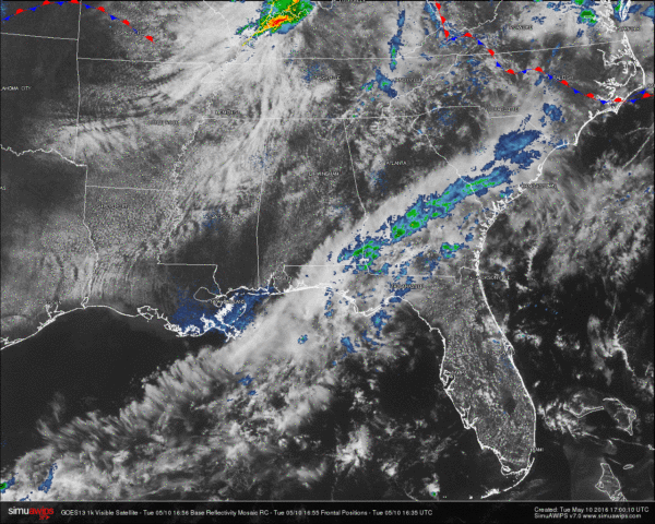
Tuesday Midday Nowcast for North/Central Alabama
We currently have a mix of sun and clouds across North/Central Alabama at this time, with temperatures on their way up into the 80s for the afternoon highs. The only rain showing up on radar for the entire state, is located over the southeast corner of the state. Showers are currently moving to the northeast through Dale, Henry, Geneva, and Houston counties.
Across the country, a line of showers stretches north of a warm front from the northwest corner of Minnesota, to the southeast through Wisconsin, Illinois, Indiana, Michigan, Ohio, and ending in Pennsylvania and New Jersey. A line of stronger showers and thunderstorms are located in Southwest Indiana and extreme Northwest Kentucky. At the moment, this line is not severe, but lightning output is pretty impressive right now.
QUICK LOOK AT TEMPERATURES: Most communities are well up into the 70s with a few in the 80s being reported. As of now, the cool spot in the state is Dothan at 72 with rain falling. Here is a list of temperature readings from across the state at this time:
Birmingham 78
Tuscaloosa 80
Muscle Shoals 76
Huntsville 78
Anniston 78
Alexander City 78
Montgomery 81
Dothan 72
Mobile 79
REST OF TODAY: Expect much of the same for the rest of the day. A mix of sun and clouds, with a small risk of an isolated shower or thunderstorm. Most of the day will remain dry, and if any storms develop, they will be widely spaced apart. Afternoon highs will be in the low to mid 80s.
WEDNESDAY: Another warm day in store for North/Central Alabama. Partly sunny with only a small chance of isolated showers. Just like today, coverage with these showers will be small, and most communities will remain dry. Highs in the mid 80s.
HEADED TO THE BEACH: A few scattered showers/storms are possible today, and then again Friday, otherwise mostly sunny days and fair nights from Panama City Beach over to Gulf Shores through early next week. Highs on the immediate coast will be close to 80, with mid 80s inland. See a very detailed beach forecast here.
THE REGIONS TRADITION: The Regions Tradition will be held this year at the Greystone Golf and Country Club May 18-22… too early for a specific forecast, but climatology suggests highs in the 80s and lows in the 60s during that part of May. Find out more information and purchase your tickets here.
WEATHERBRAINS: Don’t forget you can listen to our weekly 90 minute netcast anytime on the web, or on iTunes. This is the show all about weather featuring many familiar voices, including our meteorologists here at ABC 33/40. You can find it here.
Category: Alabama's Weather


