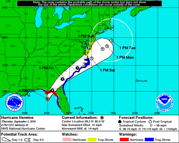
Hermine Nearing The Coast
The eye of Hurricane Hermine is only about 40 miles south/southeast of Apalachicola at 8:30 this evening…

Note the tornado warnings in the spiral band east of the storm center.
Landfall will come shortly on the Florida coast south of Tallahassee, and east of Apalachicola. Sustained winds are now 80 mph, Hermine is still a category one hurricane. It will be first hurricane to move into Florida since October 2005 (Wilma).
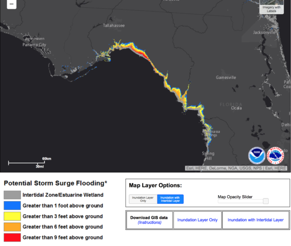
IMPACT: The main risk of storm surge inundation, flash flooding, and tornadoes will be east of the landfall point. Rain totals of 5-10″ are likely with a significant storm surge around Apalachee Bay, greater than 9 feet above ground in places.
Hermine will move into South Georgia after midnight, and into eastern South Carolina tomorrow afternoon.
GULF COAST FORECAST: Rain will end early tomorrow on the Gulf Coast, with clearing during the day. The sun should be out nicely from Gulf Shores to Panama City Beach by afternoon with only a few lingering scattered showers or storms.
Then, we expect 7 to 9 hours of sunshine each day Saturday through Monday with the routine risk of scattered storms; highs in the upper 80s on the immediate coast, with low 90s inland. All in all a nice Labor Day weekend.
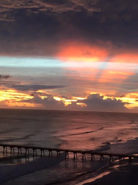
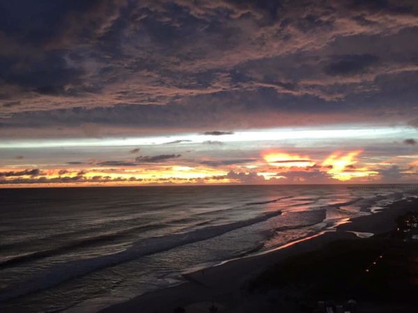
And, the sunset this evening was amazing at Panama City Beach and Destin; they are on the “good” side of the hurricane with an offshore wind flow.
We should also note that the rip current danger will slowly subside tomorrow and Saturday on the Gulf Coast as Hermine moves northeast away from the area.
Category: Tropical
About the Author (Author Profile)
James Spann is one of the most recognized and trusted television meteorologists in the industry. He holds the AMS CCM designation and television seals from the AMS and NWA. He is a past winner of the Broadcast Meteorologist of the Year from both professional organizations.Subscribe
If you enjoyed this article, subscribe to receive more just like it.


